Author: Lawrence J. Fleenor Jr

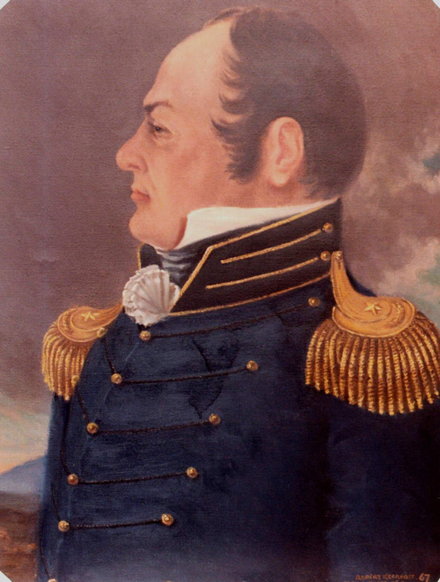
  • General Joseph Martin

    General Joseph Martin

    By: Lawrence J. Fleenor, Jr.

    Copyright January 2001
    All rights reserved
    Big Stone Gap, Va.

    Largely forgotten today, Joseph Martin played a role in the late Eighteenth Century events of Southwest Virginia and in East Tennessee unequaled by any other person. He was an explorer, trader, land speculator, soldier, politician, Indian agent, national scape goat, and the first settler of Lee County, Virginia.

    He was the second of three men of that name, his father having settled in present Albemarle County in 1729 as a neighbor of Dr. Thomas Walker, Ambrose Powell, Peter Jefferson, James Madison, and the Lewis and Clark clans. He had come from Bristol, England a few years earlier, aboard the ship ‘Brice’, and had married Susanna Childs. The couple’s first child was Joseph Junior, born in 1742.

    The boy did not take to schooling very well, and his father apprenticed him out to a carpenter. He was too wild for this, and at age sixteen he ran away and joined the British Army during the French and Indian War.

    After the war, he returned home and married Sarah Lucas (Lewcas) in 1762. Martin worked as a fur trader, as a farmer, and as a land overseer for his wealthier neighbors, and became more closely connected to Dr. Thomas Walker.

    At this stage in his life he was later described by his son, William, as having been “large of stature, six feet high, weighed 200 and one of the finest figures of a man you ever saw, with prepossessing, commanding appearance, courteous, intelligent, knew no fear …”

    Walker was chief land agent for the Loyal Company which owned 800,000 acres of undeveloped frontier land in western Virginia. Despite future Lee County’s location in Indian land protected from white settlement by the Royal Proclamation, Walker and his co-investor in the Loyal Company, the Royal Governor of Virginia, were encouraging settlement of their land, not withstanding that the Governor was responsible for the enforcement of the Royal Proclamation.

    Walker offered Martin 21,000 acres if he would become the first settler on Company land in present Lee County. Martin jumped at the chance. Walker had actually made the same offer to another group lead by the Kirtley brothers and by a Captain Rucker, with the first to arrive taking all.

    Martin’s group, which included his brother Brice, left on mach 1, 1769 and was the second to get away. Martin pushed relentlessly, and after getting lost “in the cane break and laurel” between the Valleys of the Holston and the Powell (named after Ambrose Powell), and describing himself as being “completely exhausted, weak from hunger, and very discouraged’ he found the Hunter’s Trace on their arrival in present Lee County March 26th. The competing group did not arrive until April 15th.

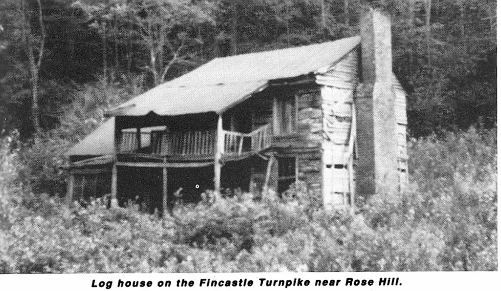
    Martin’s party quickly cleared land and built cabins on their claim, which was at present Rose Hill. Martin wrote a letter describing the area. “The place we are now settled in is waters of Beargrass, called by the hunters Powell’s River about a mile from the foot of a large ledge of mountains called Cumberland much resembling our Blue Ridge only considerably larger, much steeper and running the same course.”

    One evening, a party of Indians came in to Martin’s camp. One brave grabbed Martin’s long rifle and a scuffle developed and Martin wound up with the rifle. The Indians left in a surly mood, and Martin’s party fearing a vengeful retaliation, packed up and returned to Eastern Virginia. Martin had satisfied the stipulations for acquiring the land, and retained ownership through several treaty and legal problems.

    With his earnings from this adventure Martin bought a large tract of land in Henry County and built an estate there on the banks of the Smith River. He called the home “Scuffle Hill” in recollection of how he had earned the money to pay for it in that scrape with the Indian at far away Rose Hill.

    In 1775 Martin was made agent for the Transylvania Company and was given specific authority to control the settlement of Powell Valley. Actually, the Loyal Company and the Transylvania Company had legally competing claims to the ownership of the land in Lee County, an issue not settled in the courts until the next century.

    Martin and another group of settlers returned to his “Station” at Rose Hill. Between January and June they built a fort which was described by John Redd, a member of the party:

    “Martin’s Fort was on Martin’s Creek. The fort was located on the north side of the creek. There was some 5 or 6 cabins; these built some 20 feet apart with strong stockades between. In these stockades there were port holes. The station contained about half an acre of ground. Their shape was a parallelogram. There were two fine springs near the station on its north side. The station was not reoccupied after 1776, or during the Revolutionary War.”

    In fact, the indians ran the party out of Powell Valley a second time soon after they had finished building their settlement.

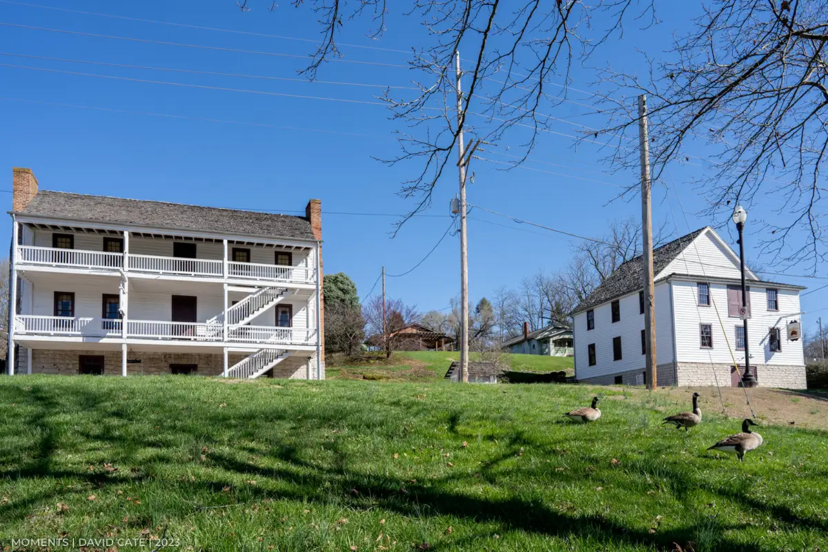
    Soon thereafter, Martin joined the Holston Militia as a captain. Virginia’s governor, Patrick Henry, appointed him as Virginia’s agent to the Cherokee, and during the winter of 1776-77 he was stationed at Fort Patrick Henry near Long Island in both capacities. He built a stone house to store the goods sent by the government for distribution to the Indians.

    The Cherokee customarily expected any outsider doing significant buisness with them to marry one of the tribe. This funcitoned as an insurer of good behavior on the parties concerned. The British Indian agents had usually complied.

    Martin married Betsy Ward, who was the daughter of the most prominent woman of the Cherokee Nation, Nancy Ward. Nancy was called “The Wild Rose of the Cherokee” and had the authority of a Chief in council. She was the daughter of Chief Oconostota, who was the brother of Emperor Attakullakulla, or Little Carpenter. Attakullakulla was the father of the famous defiant chief of the Chickamauga Cherokee, Dragging Canoe.

    By an earlier marriage to Chief Five Killer, Nancy had had a son named Little Fellow. These family connections were important in the unfolding relationship between Martin and the Indians. Martin’s wife, Sarah Lucas, knew of and sanctioned this polygamous relationship.

    Despite these tangled responsibilities and relationships, Martin was ordered to take eighty men from that garrison to the Rye Cove Fort following the murder by Indians of Isaac Crisman and his family.

    Apparantly the Cherokee had the direct route from Fort Partick Henry to Rye Cove closed at Moccasin Gap, as Martin took the indirect route via Black’s Fort at Abingdon. While the company was crossing Clinch Mountain by Little Moccasin Gap strung out in single file, they were fired on by Indians, who fled after the single volley which wounded one militiaman with five musket balls.

    Martin proceeded to Rye Cove, where he remained until the first of May. His stay at Rye Cove was eventful due to an attack lead by Little Fellow. Martin and Little Fellow fought each other in hand to hand combat, though neither was harmed. Their being brothers-in-law probably explains this exceptional outcome.

    It was also during this tour of duty that messengers from the Kentucky militia were dispatched to Rye Cove to seek aid in the relief from the attacks on the Kentucky settlements. The Indians surrounding the fort killed one of the messengers, but one of the Indians was wounded and crawled off into a came. Martin himself went in after him and killed him.

    When he and his garrison were ordered back to Long Island. He stayed at Fort Patrick Henry until the peace treaty was signed with the Cherokee July 1st.

    Throughout 1778 he engaged in counterespionage against the British Indian Agent. Martin wrote John Stuart, the British Superintendent for Indian Affairs, Southern Department, and feigned turning traitor. The British were not fooled, and Stuart commissioned a white man named Gray and a party of Chickamaugans to assassinate Martin.

    They found him in the home of his Grandfather-in-law, Chief Oconostata, who refused to give him up. The hit team skulked around for a while, but upon reflection they returned home.

    The Chickamauga Cherokee did not sign the treaty of peace when the other Cherokee had done so, and they continued to make war on the Holston, Clinch, and Powell Valleys.

    In April 1779 Col. Evan Shelby lead an amphibious expedition against the Chickamauga towns, an event that caught Indian Agent Martin in these villages. Shelby had sent warning to Martin but the messenger drowned in route. It is not recorded how Martin got out of that scrape.

    In 1780 the Revolutionary War was coming to a climax. The British were rampaging at will throughout the South, and they had the Mingo, Shawnee, and Cherokee ravaging the frontier. The British threatened to cross the mountains and to hang the leaders of the settlers.

    The militia’s customary military strategy was to carry the war to the enemy, so they resolved to cross the mountains themselves and to attack the British. However, the fear that the Indians would attack the settlements in the militia’s absence resulted in a complex rear guard aciton.

    The militia of the Clinch Valley forts would remain in place to defend against the Shawnee and Mingo. There was no milita to spare to defend the Holston and French Broad settlements, so Martin was given the task to neutralize the Cherokee diplomatically during the militia’s absence.

    This, perhaps, was his finest hour, because he did succeed in this effort, and by so doing he made the vistory at the Battle of King’s Mountain possible.

    The Cherokee began to attack the settlements again and in January 1781 when the militia had returned from King’s Mountain Martin was part of the expedition against the Overhill Cherokee in the area of Tellico and Hiwassee. He met with outstanding success, and was able to dictate peace terms requiring the chiefs to meet with him as Indian Agent at Long Island on the Holston.

    Despite this newest peace treaty with the Cherokee, British Indian Agents succeeded in provoking more raids into Powell Valley and against Fort Blackmore. Martin, now a Colonel, was dispatched with a company of militiamen into Powell’s Valley where they chased the Indians all the way into Tennessee, to the junction of the Powell with the Clinch.

    Sarah Lucas Martin died in 1782, and two years later Martin married Susannah Graves, who also accepted his relationship with Betsy Ward. Indeed, Martin took his Indian son back to Eastern Virginia to get an education., and Susannah graciously received Betsy when she visited Scuffle Hill.

    After the end of the Revolution pressures for settlement of the Cherokee land greatly increased, and Martin gradually saw his role as one of finding a formula to protect the Cherokee. Oconastota actually charged him with the task of finding an equitiable settlement for the Cherokee.

    Martin had some temporary seccesses and negotiated boundary lines and payment in trade goods for the Cherokee. Hatred of Martin by the settlers began to become an open sore.

    About 1783 Martin became a North Carolina State Senator representing Sullivan County (now Tennessee). Somehow he kept his commission in the Virginia Militia, and even was promoted to general. He conducted campaigns against warring Indians who did not quit fighting when the British did at the signing of the treaty ending the Revolutionary War. He also served on road commissions in Virginia during this period.

    In 1783 the Governor of Virginia directed that a fort be built at Cumberland Gap and that fall Martin returned to Powell Valley and built his “New” or “Lower” Station on Station Creek (the westernmost of the two Sttion Creeks in Lee County) two miles from Cumberland Gap. It was constructed as a blockhouse, rather than as a palisaded fort like the “Old” or “Upper” Station at Rose Hill.

    In 1784 Georgia appointed him commissioner to deal with settling the status of the Cherokee lands around Muscle Shoals, Alabama.

    Irreconcilable conflict arose when North Carolina opened its land office and began to distribute land in the French Broad Valley to Revolutionary War veterans. Martin was still that State’s Indian agent, and was not informed of the change in policy. He was also still Virginia’s Indian agent to the Cherokee, and that State continued to pursue the policy of keeping settlers out of Indian treaty lands, specifically the French Broad.

    At this point, the Congress of the Confederation took Indian affairs out of the hands of the States, and appointed a commission that included Martin to deal with the Cherokee. The Treaty of Hopewell was the result, and was the first treaty between the United States of America and the Cherokee.

    The practical effect of the treaty was to infuriate the settlers, who felt that they had been sold out by the national government.

    In 1784, East Tennessee seceded from North Carolina and formed the State of Franklin, with the old Indian hater John Sevier as governor. Far Southwest Virginia was invited to join.

    Martin clearly saw that the intent of the new State was to take by force all the Cherokee lands, and that the only way he could prevent this from happening was to ally himself with the national authority and with North Carolina, which opposed the secession.

    The governor of North Carolina ordered the arrest of John Sevier, and the Franklinites surrendered in 1788. This would seem to have been a great victory for Martin, but it was the beginning of the end of his role on the frontier. Even though he received more promotions for his successes, he was so alienated from the settlers that he became unable to function.

    His son William was killed on his way to Georgia by a Creek Indian in 1786. As late as 1787 the Cherokee were still raiding Powell Valley and in the fall of that year Virginia removed him as Indian Agent, possibly because he had been unsuccessful in stopping the Indian raids.

    In 1788 Martin sold his Lee County holdings, and in 1789 he returned to his Scuffle Hill family, never to return to far Southwest Virginia and Northeast Tennessee. His commission as United States Indian Agent was allowed to expire. What happened to Betsy Ward is not recorded.

    His Old and New Stations were still garrisoned by militia as late as 1792 when Powell Valley was threatened by an invasion of 1000 Cherokee warriors.

    In 1793 Martin was elected to the Virginia General Assembly, a post he kept for twelve years. In 1795 he helped negotiate boundary disputes between Virginia and the States of Tennessee and of Kentucky.

    In 1808 the British were again inciting the Cherokee to warfare, and the aged Martin was commissioned one last time to make peace. He returned from the trip to Tennessee worn out, and died of a stroke on December 18, 1808.

    His white children included Brice, John, Joseph, Lafayette, and William. His children by Betsy Ward are not documented, but the William that was killed by a Creek Indian likely was one of them, as the white William was a well known attorney in Henry County, and lived to write a biography of his father.

    Who the William Martin that owned land on Indian Creek and who died in Lee County in 1821 was is not known. Neither is it known if the Brice Martin that owned land among Joseph’s holdings between Rose Hill and Ewing was his brother or his son.

    Today, the irreconcilable Indian fighters like John Sevier, William Blount, and the Shelby brothers are well remembered. Towns, schools, and other things of importance are named to commemorate them.

    Joseph Martin, the peace maker, is best remembered by the creek which starts at the spring that supplied his Upper Station and which bears his name. Perhaps it is fitting, as it is a favorite of trout fishermen, who pursue their peaceful passtime in its cool waters.

    MARTIN’S LEE COUNTY LAND HOLDINGS

    The constellation of Martin’s properties centered around his Lower or New Station near Shawnee, Tennessee, and his Upper or Old Station properties around Rose Hill and Ewing. There was a total of 1,349 acres running from US 58 in Virginia to Harrogate, Tennessee that was the Lower Station tract. The state line between Tennessee and Virginia at that time ran south of Harrogate, and all these properties were entirely in Virginia.

    The Upper Station properties owned by Joseph Martin total 2,775 acres, including 365 acres that Joseph sold his right to James Campbell before he registered them with the State Land Office. In addition there are two tracts in the middle of this string of tracts that belonged to Brice Martin which totalled 1,220 acres. It is not known if this Brice Martin was the son or the brother of Joseph.

    In addition Joseph Martin owned four tracts of land down Martin’s Creek near its mouth and in the watershed of Four Mile Creek, which totaled 1,126 acres. He also owned 291 acres at Dot next to the Rocky Staton tract of Isaac Chrisman, Jr. This brings the total land holdings of Joseph Martin within the historic bounds of Lee County, Virginia to 5,541 acres.

    Bibliography

    1. Addington, Robert M. – HIstory of Scott County, Virginia
    2. Summers, Lewis P. – History of Southwest Virginia and Washington County
    3. Hamilton, Emory – “Historical Sketches of Southwest Virginia”, publication #4
    4. Bristol Herald Courior – June 1, 1980
    5. Morrison, Denise Pratt – Joseph Martin and the Southern Frontier
    6. Laningham, Anne W. – Early Settlers of Lee County, Virginia and Adjacent Counties
    7. Land grant research by the author and by Dale Carter
    8. Virginia State Library
  • The Historic Environment of the Forts of The Holston Militia

    The Historic Environment of the Forts of The Holston Militia

    Copyright and All Rights Reserved by:
    Lawrence J. Fleenor, Jr.
    Big Stone Gap, Va. March 2005

    Three battles or military campaigns that shaped modern America were fought by the settlers of Southwest Virginia and Upper Northeast Tennessee.  They fought as units of the Virginia Militia, a formally organized arm of the Commonwealth.  At the time, they were usually referred to as “The Holston Militia”.

    The American Revolution is generally said to have run from 1775 to either 1781 or 1783.  However, in the Valleys of the upper Holston, Clinch, and Powell Rivers the conflict lasted from 1774 to 1794, and was fought against the Mingo, Shawnee, and Cherokee, as well as the British.  During the years 1775 to 1781, these Indian tribes were both instigated and armed by the British to fight the Americans as a major strategic campaign by the British government as part of its efforts to subdue the insurrection.

    The Revolution had its origins in the settlement of the French and Indian War. While it is true that in the Northern Colonies issues of the tea tax, and the Stamp Act were of paramount importance, the issue of greatest importance in the South was the British closing of the frontier.

    In Virginia settlement was to be confined to east of the New River.  At the time of the French and Indian War, there were permanent settlements already established in the Holston Valley, and there were semipermanent hunting camps in the Valleys of the Clinch and Powell.

    Nevertheless, both settlement and land sales within the lands west of the New River proceeded, even with the active connivance of the Royal Government of His Majesty’s Colony of Virginia.

    The Shawnee, and their allies, the Mingo, owned the New River Valley.  In 1774 they launched a military effort to clean this region out of its illegal settlements.  In response to this threat, Lord Dunmore, Governor of Virginia, ordered the frontier to be fortified.  Following their invariable practice of carrying the war to the enemy, rather than passively waiting for him to invade their homes, the Militia marched down the New River, and collided with the Shawnee at its mouth, where on October 10, 1775 the Battle of Point Pleasant, the only battle in Lord Dunmore’s War, was fought.  The fighting was intense, and lasted all day long.  It could have gone either way, but in the end the Shawnee returned to their towns on the Scioto River in Ohio.  The militia followed and laid waste to their towns.

    In 1775 Daniel Boone started leading immigrants into Kentucky, which was also Shawnee territory.  Theodore Roosevelt, in his two volume history, The Winning of the West, sagely observed that if the Militia had lost the Battle of Point Pleasant, the United States’ western border would today be the Alleghenies.  There would be nothing American west of Cumberland Gap.  As it was, the settlement of Kentucky and of the Old Northwest Territory was a very close thing, and almost failed.  However, due to the punishment taken by the Shawnee in Lord Dunmore’s War, they were too shaken to have opposed these western settlements to any significant extent for two years after the Battle of Point Pleasant, and by the time they began their campaigns against these settlements, they were too deeply seated to be uprooted.

    The same proposition can be made for the Great Cherokee War of 1776.  The British armed the Cherokee, and sent them against the settlements in the Holston, Clinch, and Powell Valleys.  To meet this threat, new forts were built.  The Cherokee did succeed in driving all the settlements out of Lee County and forced the evacuation of all of their forts except for the one at Rocky Station.  The Holston Valley was evacuated all the way back to Black’s Fort at Abingdon, and after a number of attacks, Fort Rye Cove was evacuated in Clinch Valley.  This severed the Wilderness Road that sustained the Kentucky settlements.  Before its evacuation, the garrison at Rye Cove Fort saved Kentucky, and its settlements barely held on.  But, again, it was an extremely close thing.  If one lone militia messenger from the Kentucky settlements had not succeeded in penetrating the Cherokee pickets at Rye Cove, the USA would never have made it west of Cumberland Gap.  On at least three occasions, the garrison of Rye Cove sent relief forces on the run to relieve Shawnee sieges of Boonesboro, Kentucky.

    In the fall of 1780, again the Holston Militia fought a battle that saved America.  The British had given up on trying to win the Revolution in the North, and had invaded the South by Charleston, South Carolina.  Lord Cornwallis was marching north toward Virginia, and had a unit of crack American Loyalist troops under Col. Ferguson screening his movement from possible attack by the Holston Militia.  Indeed, the Holston Militia fell upon Ferguson’s command at the Battle of King’s Mountain in South Carolina on October 7, 1780.  Ferguson was killed and his troops nearly annihilated.  This battle set in motion a series of events that in the end forced Cornwallis to take his army to the coast at Yorktown, Va., where they could receive the protection of the British Fleet.  The rest is history.

    The British forgot to tell the Cherokee to quit attacking the frontier when they, themselves, quit fighting.  The Cherokee maintained a bloody warfare against the frontier settlements until April 1794.  Indeed, the two decades that the Holston Militia fought for its existence was the bloodiest and longest war with the Indians in the United States.

    This era of American history can be best understood by a study of the system of forts constructed by the Holston Militia in the Valleys of the upper Holston, Clinch, and Powell Valleys.  The book, The Forts of the Holston Militia, details the location of 36 of these structures, and gives period narratives concerning them to provide context.

  • The History of Yellow Creek

    The History of Yellow Creek

    Copyright:  Lawrence J. Fleenor, Jr.
    All rights reserved
    Big Stone Gap, Va.
    Feb. 2004

    Yellow Creek runs throughout American History, and its implications for Southwest Virginia and East Tennessee are tremendous.  The course that the stream cuts through our past is intriguing and far reaching.

    The Indian Confederacy that lived in the Hudson and Mohawk River Valleys is referred to in the English tradition as the “Iroquois”, but the first European settlers of that region were the Dutch, and they referred to these Indians as the “Mingo”  (a competing scholarly tradition holds that the Mingo are the remnants of the Erie, who were mostly wiped out by the Iroquois).  This Confederacy consisted initially of five separate tribes, the Mohawk, the Oneida, the Onondaga, the Cayuga, and the Seneca, and later were joined by their cousins from North Carolina, the Tuscaroras.  They held suzerainty over other great tribes, such as the Delaware and the Shawnee.

    For reasons that are lost to history, in the 1750’s fragments of several of the separate tribes of the Iroquois and of the tribes dominated by them came to live together as a “tribe” or as a confederacy in the Ohio Valley.  The earliest references to them call them “the Ohio Seneca”.  George Washington’s 1753-54 map of the Ohio country shows “Mingo Town” as being on the Ohio River about 20 miles below Pittsburgh.  Later they lived among the Shawnee on the Scioto River in Ohio, and later still in modern Mingo and Logan Counties, West Virginia, in the area of Williamson.

    John James Logan is the best known leader of the Mingoes.  Born in 1725 and named Tah-Gah-Jute, his mother was a Cayuga and his father, Shikellamy, was a French Canadian who had been captured as a child by the Oneida and had been raised as one of them, and later became a chief of that tribe.  The Iroquois sent Shikellamy to their subservient tribe, the Delaware, as their representative.  In that capacity he made the friendship of the Secretary of the Colony of Pennsylvania, James Logan, and named his son after him.

    After the tribal displacements of the French and Indian War John Logan moved to Ohio and married a Shawnee, and the early 1770’s found them living in Western Pennsylvania just to the east of Wheeling.

    Hermann Groethausen was born in Germany, and immigrated to Pennsylvania.  His son was Harman Greathouse, settled in Holiday’s Cove in current West Virginia.  One night his cabin was attacked by a party of Indians, who tried to pry open the door while Herman was shooting at them out the cabin’s portholes.  Mrs. Greathouse and a Mrs. Muncy made a great commotion inside the cabin, and called out imaginary men’s names, urging them to arm themselves with powder and ball.  Then the intrepid Mrs. Greathouse fired a rifle from the upstairs window, and the Indians, convinced that the house was filled with armed men, left.

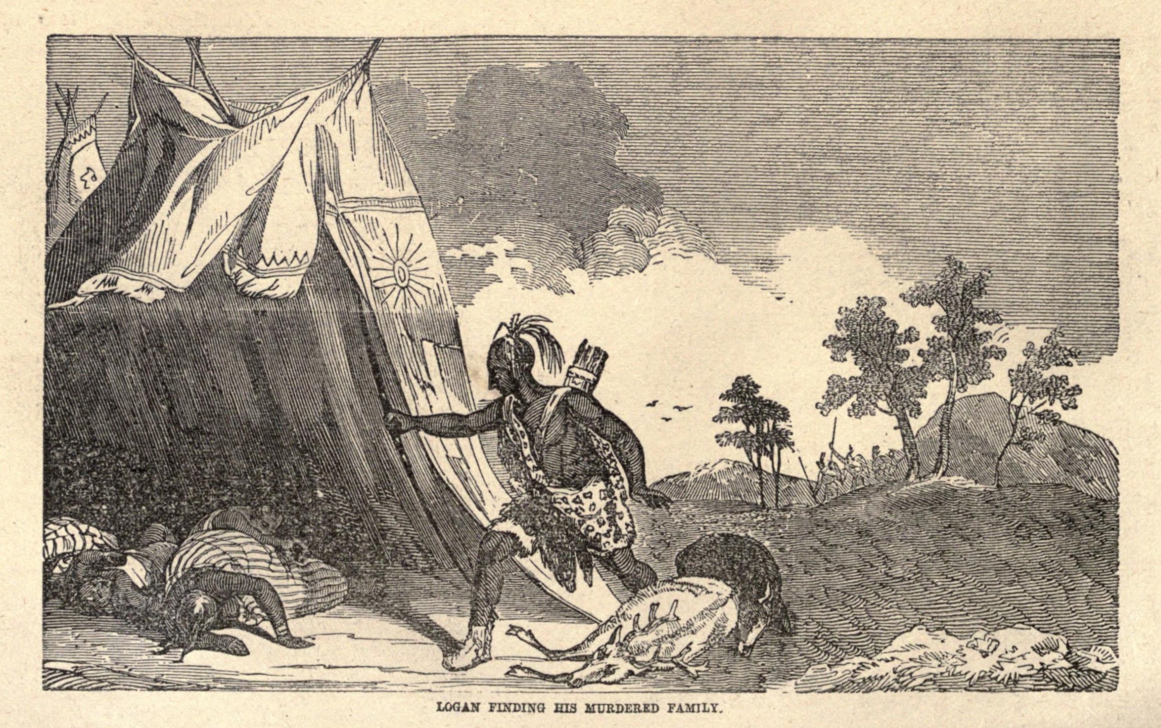
    Herman had a son named Daniel, and who lived on his 400 acres in 1771 at Mingo Bottom in Ohio County, Virginia (now West Virginia).  Yellow Creek flows into the Ohio some forty miles above Wheeling.  A Mr. Baker operated a tavern at the mouth of Yellow Creek, and sold alcohol to both Whites and to Indians.  Tensions were already heightened due to several murders back and forth among the settlers and the Indians.  Who had drawn first blood is long forgotten.  Word was sent out from Fort Pitt for the settlers to congregate at the fort, as war seemed likely.  Baker was preparing to evacuate when a squaw came across the river and told him that the Indians were preparing to murder him and his family.  Baker called for help, and Daniel Greathouse and 21 other men responded, and on April 30, 1774 they concealed themselves in Baker’s back room.  Soon nine (some records say seven) Indians, including almost all of Logan’s kin, crossed the river and came into Baker’s Tavern.  Among them were Logan’s brother, and two women and a child.  The Indians drank heavily, and Logan’s brother put on a coat and hat belonging to one of the white men, and was promptly shot.  The concealed Greathouse party then rushed out of the back room, and killed all the Indians except for the child.  They then rushed out of the house and saw two canoes filled with armed war painted Indians crossing the River toward the tavern.  The whites fired on the Indians, killing most of the occupants of one of the canoes, and driving the second back across the river.  Greathouse scalped the Indians, and tied the trophies to his belt.

    Weeks before the Yellow Creek massacre, some Cherokee had stolen a settler’s horses, and had killed two of the whites.  On April 16th the Cherokee killed some employees of the trader Butler.  Emotions on the frontier became superheated.  A Captain of Rangers, Michael Cresap, was near Wheeling at the time, and recruited some backwoodsmen and declared war on all Indians.  They planted a war post, and did a war dance around it.  On the 27th, Cresap, and his militia company murdered some peaceful Indians that likely included friends and relatives of Logan.  The next day Cresap and his men attacked a party of Shawnee who had come to trade at Fort Pitt, and killed one of them and wounded two others.  At the time, Cresap publicly boasted of the murders.  What really were three separate massacres became quickly fused in people’s minds as a single event.

    This “Yellow Creek Massacre” was the immediate cause of Lord Dunmore’s War of later in 1774.  Tensions were already high because the Iroquois had negotiated the Treaty of Fort Stanwix, in which they ceded their lands in the Ohio Valley south of the river to the British.  While the Iroquois themselves did not live there, their subservient tribes, the Shawnee and the Mingoes, did.  After Yellow Creek, the Shawnee and the Mingoes went on the war path, and Logan went berserk.  Lord Dunmore was the Royal Governor of Virginia, and led a two pronged attack against the Shawnee.  One column Dunmore, himself, led down the Ohio River from Fort Pitt, while another consisting of frontiersmen from Southwest Virginia, collided on October 10th with the Indians at Point Pleasant, where the Great Kanawha River meets the Ohio.  A terrible day long pitched battle occurred, and at the end the Shawnee withdrew from the field and returned to Ohio.  It had been a near thing.  This “Battle of Point Pleasant” is often referred to as the only conflict of the war.  This was not so.  The entire frontier from Pennsylvania to Tennessee had been involved in raids and killings.

    The Indian strategy had been for the Shawnee under Chief Cornstalk to march up the Kanawha / New River into Virginia, and to drive the settlers out.  Being a much smaller tribe, the Mingo had been assigned the task of harassing the settlements in Southwest Virginia and East Tennessee in order to draw off militiamen from their campaign to attack the Shawnee.  Logan, admittedly lusting for blood after the Yellow Creek Massacre, led his warriors into the Valleys of the Clinch and Holston.

    On September 8th Logan and his Mingo attacked the North Fork of the Holston and assaulted Samuel Lammey, John and Archibald Buchanan, and John Henry.  The settlements on the Main Fork of the Holston evacuated to Royal Oak at Marion.  On September the 13th Mingoes attacked a militiaman near Maiden Spring Fort in Tazewell County.  On the 23rd Logan and his warriors attacked Fort Blackmore in Scott County.  They then went on the 24th to King’s Mill (Kingsport) and killed the John Roberts family, except for a boy whom they took captive.  Then on the 29th Logan went to Moore’s Fort in Castlewood where Daniel Boone was in command, where John Duncan was killed.  On October 9th they simultaneously again attacked Fort Blackmore and the Fort at Sapling Grove (Bristol Tennessee).  Logan was pursued back into West Virginia by way of the Breaks of the Big Sandy by a party of militiamen led by a man named McClure, all to no avail.  Logan personally took thirty scalps during the war.

    After Logan’s raid, Arthur Campbell, the commander of the Militia, sent in a report to his superiors, which included the story of the eight year old son of John Roberts, who had been tomahawked and scalped and who was later found by his uncle.  Campbell said, “…and he (the boy) returned sensible answers, shewed his murdered patents and sisters, his brother is not found, and I suppose captured.”  The boy had received “but one blow with a Tomhake on the back of his Head, which cut thro his scull, but it is generally believed his Brains is safe, as he continues to talk sensibly.”  The boy lived two weeks.  Campbell further reported that “the boy who was scalped is dead.  He was an extraordinary example of patience and resolution in his last, frequently lamenting he ‘was not able to fight enough to same his mammy’.”

    To drop back in time a little bit, in July Logan had captured as settler named William Robinson on the Monongahela River.  Robinson was tied to the stake by Logan’s braves, with intent to torture and then to burn him alive.  Logan cut Robinson loose from the stake, and three days later Logan came to Robinson with paper and gunpowder ink and asked him to write down the following message:

    “Captain Cresap – What did you kill my people on Yellow Creek for?  The white     people killed my kin at Conestoga a great while ago, and I thought nothing of     that.  But you killed my kin again on Yellow Creek, and took my cousin prisoner.      Then I thought I must kill, too, and I have been three times to war since; but the     Indians are not angry, only myself.  July 21, 1774 – Captain John Logan”

    This message was carried by the war party on their foray into the Holston Valley, and was left by the bodies of the Roberts family at King’s Mill.  Logan seemed to not know of the role that Greathouse had played in the massacres, and he came to blame Cresap alone for them.

    This sentiment came to light again in a statement dictated by Logan at the peace negotiations that ended Lord Dunmore’s War.  Logan would not appear at the peace conference, his attitude being characterized by the other Indians as “being like a mad dog, with his bristles up.”  Lord Dunmore sent an aide named John Gibson to plead with him.  Logan instead dictated the following message:

    “I appeal to any white man to say if ever he entered Logan’s cabin hungry, and he     gave him not meat; if ever he came cold and naked, and he clothed him not.      During the course of the last long and bloody war Logan remained idle in his     cabin, an advocate for peace.  Such was my love for the whites that my     countrymen pointed as they passed and said, ‘Logan is the friend of the white     men.’  I had even thought to have lived with you but for the injuries of one man.      Colonel Cresap, the last spring, in cold blood and unprovoked, murdered all the     relations of Logan, not even sparing my women and children.  There runs not a     drop of my blood in the veins of any living creature. This called on me for     revenge.  I have sought it; I have killed many; I have fully glutted my vengeance.      For my country I rejoice at the beams of peace.  But do not harbor a thought that     mine is the joy of fear; Logan never felt fear.  He will not turn on his heel to save     his life.  Who is there to mourn for Logan?  Not one.”

    Even though the settlers had won Lord Dunmore’s War, it remained a bitter experience for many.  Due to Logan’s pronouncements, which were widely printed in newspapers up and down the colonies, Cresap was the recipient of much hatred by the whites.  George Rogers Clark, who was soon to become famous as the conqueror of the Old Northwest Territory, was a member of the Cresap company, and knew the truth about the recent massacres and of Cresap’s role in them. As the militiamen were discussing Logan’s speech around the campfire, Clark turned to Cresap and jeered and rallied against him.  Cresap was much angered, and swore that he had a good mind to tomahawk Greathouse.  Cresap hated Greathouse as long as he lived, and history has largely exculpated him of his role in the massacres.

    After the peace conference had ended, Patrick Porter, a militiaman from present Dungannon, Scott County, Virginia, was preparing to return home when Logan approached him.  Logan asked Porter to take a Mingo orphan boy, whose parents had been killed by whites, home with him.  Porter at first refused, fearful that the Mingoes would follow and kill him.  But Logan said that he would tell the Indians that the boy had drowned.  Logan said further, “I want you to take Dale, the lonely Mingo boy, because he wants to go with you, Patrick.  It is strange.  It is strange indeed that he wants to go with you.  But he says he wants to learn to read and write.  He says you can teach him. He wants to become a missionary among the whites.  Porter replied again, “I am afraid your tribesmen will come to the Clinch and kill my family.”  “Mr. Porter”, Chief Logan said, many a time I was on the Clinch River.  Many a time I could have killed you.  But I did not.  I did not because I heard you were a good man.  You are good to your children, I’ve heard. That makes me love you.  I know you will be good to Dale.  I was near your fort on the Clinch once and I was about to steal your horse.  It was just after night fall. I put a small shock of fodder over me and I moved toward your fort.  Then I heard a child scream and I thought I was detected.  I threw down the fodder and ran.  Mr. Porter, did you see that fodder shock?”  ‘Yes,” said Mr. Porter, “I saw it.  I was on guard at the fort gate that night.  I saw the fodder moving and I knew an Indian was in it.  I pointed my gun and cocked the hammer.  Then a child fell out of bed.  When it screamed the fodder dropped.  I saw a man run.  I went into the house.  The child had broken its arm.  And that saved you, Logan.  I had as good a bead on you with as good a gun that was ever fired.”  Logan grunted and said, “the Great Spirit will not let one friend kill another.”  Patrick Porter took the Mingo boy, Dale, home with him to the Clinch.  He gave him the first name “Arter”.  Arter Dale learned to read and to write, using the Bible as his text.  He married a white woman and moved to the Hurricane section of Wise County, where he is buried, and where many of his descendents live today.

    Lord Dunmore’s War proved to be only the opening phase of the Revolutionary War.  The British continued to follow a policy of limiting western expansion of the colonies, while guaranteeing the Indians peace in their homes.  Lord Dunmore’s War, like the earlier French and Indian War, only strengthened the British in their resolve to keep the peace at the price of stifling the western expansion by the colonial settlers.

    At the very time that the War was being fought, affairs in Boston were reaching an obvious point of political explosion.  The militia on its return from the Battle of Point Pleasant was acutely aware of these events.  When the militia reached the mouth of the River Hockhocking, the officers held a meeting.  They wrote a statement for publication stating that while they had followed the English Earl into battle, they were in fact in sympathy with the Continental Congress, then in session at Philadelphia.  They expressed devotion to the King, but only as a free people, and remarked that they could fight as well as any army in the world.

    Lord Dunmore returned to Virginia to public acclaim, but within months of his return he was forced to flee to England in the opening strife of the Revolution.

    The beating that the Shawnee received at Point Pleasant kept them peaceful during the first two years of the Revolution.  It was during this hiatus that settlements in Kentucky gained a foothold, one which proved strong enough that when the Shawnee did regain their courage their attacks on the settlements in the Blue Grass proved to be ineffective.

    George Rogers Clark left Cresap’s command and moved to Kentucky, where he captured the Old Northwest Territory, or the lands between the Mississippi River and the Ohio River.

    None of this would have been possible if the Indians had not lost the Battle of Point Pleasant, and that battle was the result of the massacre at Yellow Creek.  It is quite likely that without Lord Dunmore’s War the United States of America would have found its western boundary to have been located along the Alleghany Mountains, with Kentucky and the Old Northwest Territory having remained British Indian Territory.

    Thomas Jefferson published Logan’s speech in his “Notes on Virginia”, and was very critical of Cresap.  Twenty three years after these events had occurred, the Yellow Creek massacre and Jefferson’s criticism of Cresap found themselves to be at the center of American national politics.  Jefferson, the founder of the Democratic Party, found himself locked in an acrimonious conflict with the Federalists.  One Luther Martin, a Federalist, and who just happened to have been Cresap’s son-in-law, bitterly attacked Jefferson in public print for ‘wrongly’ defaming the reputation of Cresap. This theme was picked up by a Mr. Jacobs, who wrote a biography of Cresap and did his best to denigrate Jefferson.  The process would not die, and Neville B. Craig published an article in the  historical magazine, “The Olden Times”, rehashing the issues.  And, even later, Brantz Mayer published a book Logan and Cresap.  By this time the nation was heading towards Civil War.

    Logan became a sullen alcoholic, and in 1780 he knocked his wife unconscious.  Thinking that he had killed her, he fled, and was pursued by a party of Indians.  He was cornered and killed by his nephew.

    Michael Cresap returned to Maryland, and even though ill, he raised a company of militiamen who rushed to the defense of Boston, where Cresap died in 1775.

    That year also claimed the life of Daniel Greathouse, who died of measles at the age of 19.

    Bibliography:

    Encyclopaedia Britannica – 1965 edition – vol. 14 pg 205
    Eckert, Allan W. – A)  The Wilderness War, pg. 273 and others
    B)  Wilderness Empire
    Appletons Encyclopedia 2001 Virtualogy
    “West Virginia” Microsoft Encarta Online Encyclopedia 2001
    http://www.swcp.com/~dhickman/notes/mingo.html
    Roosevelt, Theodore – The Winning of the West
    A)  Part I – The Spread of the English Speaking Peoples
    B)  Part II – In the Current of the Revolution
    History of the Panhandle, West Virginia
    http://home.sprintmail.com?~robtmarj/greathouse.html
    Addington, Robert M. – The History of Scott County, Va.
    Summers, Lewis Preston – The History of Southwest Virginia and Washington County
    Fleenor, Lawrence J. – The Bear Grass, a History
    http://members.aol.com/CaptCresap/page/
    Neal, J. Allen – Bicentennial History of Washington County, Virginia
    Addington, Luther F. – The History of Wise County

  • The Economic Engines That Fueled The Far Southwest Virginia Frontier

    The Economic Engines That Fueled The Far Southwest Virginia Frontier

     By Lawrence J. Fleenor, Jr. & Edgar A. Howard

    copyright- all rights reserved
    Big Stone Gap, Va.
    Dec. 1999

    No society exists independent of its economic structure, and the economy of the frontier of far Southwest Virginia and adjacent parts of Kentucky and Tennessee has not been extensively studied. The frontier period was surprisingly short. A trickle of settlers began to take up land patents in Washington County and Scott County, Virginia in the mid 1760’s, and the settlement of the larger region of far Southwest Virginia was in full swing by a decade later. Land purchases by outsiders immigrating from the East had almost stopped by 1800, as by then the frontier had moved on to the West. Most of the land exchanges in these counties began to be between the original settlers and their children and their neighbor’s children. The last Indian raid into Virginia was the April 1794 Livingston raid by Chief Benge of the Chickamauga Cherokee. That year Col. James King started his iron works at the mouth of Steele Creek in Bristol. He shipped iron products “throughout the South” by boat from Kingsport, and paid his teamsters in cash. In 1803 James King, brother of William, started the Saltworks in Saltville. It was an industrial operation, with exports throughout the South, and with its commerce being conducted across a toll road running between Abingdon and Saltville, with tolls payable in cash only.

    So the frontier period of this region ran roughly from 1765 to 1794, or 1800 at the latest. What was the economic structure that supported this frontier society, and how did it evolve so rapidly into a cash based farming and industrial one?

    Even though original land patents and grants averaged around 150 acres, a number of the settlers were able to amass considerable estates consisting of thousands of acres of land, and of slaves. Neither were cheap. Land sold for an average of $3.00 – $5.00 an acre. Estates of 2,000 – 3,000 acres were not rare. Slaves cost $300 – $500 each, and even though most settlers did not own any, the large estates might average about a half dozen or so. Therefore, some settlers were able to amass estates worth about $14,000 in land and in slaves alone. (3,000 acres of land X $4.00 = $12,000 plus 6 slaves @ $400 = $2,400.)

    In order to give some means of reference to understand the magnitude of this wealth in terms of that era, consider the value of the following items, taken from estate appraisals of that time and place:

    wagon $65.00
    woman saddle and gear 7.00
    cow 7.00
    horse 50.00
    rifle gun 5.00
    maple sugar per pound .10
    hog 1.00
    sheep 1.00

    The life story of the typical settler was that he had arrived in North America either near penniless or in significant debt. After working out their indebtedness, they frequently hired on as farm hands in the East, where half a generation might pass before they had acquired enough cash to buy a land warrant from the government, to buy a little farming gear, and to support themselves and their family until they could make a home on their new land on the frontier. Once this was done, few had any extra cash left over.

    The commonly held view of the frontier is that it was a cashless society, economically disconnected from the East, functioning on a barter economy based on an industry of hunting and gathering, and of marginal agriculture. If this were true, where did the cash come from to pay for the rapid build up of those wealthy estates, events that occurred with startlingly little passage of time?

    Another question to be answered is why was it so common for some settlers to choose forested hilly or mountainous land for themselves, rather than the already cleared Indian fields in the river bottoms? Some of the first settlers did so, even when rich bottom land lay close at hand. Examples are the drainages of Cove Creek and of Smith Creek in Washington and Scott Counties, which were acquired early on by both settlers and by local land speculators. And then there is the widely held tradition that the settlers came looking for good land to grow tobacco. What evidence is there that tobacco was a significant factor in the local pioneer economy?

    The local economy generated no cash within itself. All cash had to come from the East. The original settlers arrived with little disposable cash left over after they had established their homes on the frontier. So, by what means did they bring in all that cash from the East? Certainly, in the beginning, additional settlers from the East brought in cash with them, which they exchanged with the earlier settlers for land. But, as we have seen, this process had ended by approximately the year 1800, as settlement moved on to the West as the frontier rolled on. Where did the prospering large estate builders and the children of the original settlers get the cash to buy their land after the infusion of money brought in by the late arrivals dried up? It could have only come from the production and export and sale to the East of some transportable commodity which was in demand in the East, and which could be transported the four hundred miles or so to the cities and ports there. Could the forested hilly, mountainous, land so often sought by the original settlers have been part of the answer?

    The hills of Far Southwest Virginia contained no valuable minerals, except for coal, which was not yet in commercial demand, and was too bulky to transport in the pioneer period. The hill crests were covered with a chestnut dominant hard wood forest. The lumber was too bulky to transport, and too common in the east to have been valuable. Whisky and tobacco are sometimes mentioned as export commodities by those few people who believe that the frontier had any economy other than one of local barter. But even whisky was bulky and wooden barrels difficult to transport on a trip that took a season to complete. Tobacco was even more bulky, and required weather proof transport in giant wooden hogsheads over impassable muddy roads. Tobacco’s value was waning by this time, and even the giant plantations of the Tidewater estuaries, such as Mount Vernon, were abandoning it in favor of bulk grains. What evidence is there of significant whisky or of tobacco exporting?

    Perhaps the ethnic history of the settlers might contain some clue. Most of the English stayed east of the Blue Ridge. The settlers of Far Southwest Virginia were mostly from either Scotland, Ireland, or Germany.

    The Scots-Irish are known for their habit of making whisky. But they had also been sheep herders in the old country. Long distance cattle and sheep drives had been a cultural hallmark for them, as well. Could the production and export of either live sheep, or of mutton, or of wool have been the answer to the economic riddle? The Virginia and Kentucky frontier is the wettest region of the contiguous United States, except for the coast of Washington and Oregon States. Sheep get a disease called ‘foot rot’ when they are raised in wet regions, and they also tolerate the summer’s heat in this region poorly. Sheep also need lots of grassy pasture to live on, and in the early years there was not much of that around. Tax records and estate appraisals of that era show that, while many settlers had some sheep, most did not keep more than they needed themselves for wool. In fact, the rapidity with which the Scots-Irish dropped their traditional sheep herding ways once they arrived in this country is startling.

    The Germans, on the other hand, had lived in Europe on an economy based on raising hogs by letting them run loose in the woods, where they ate the wild nuts – primarily acorns. German cuisine was pork based. Is there any evidence that the commodity that generated the cash that supported the frontier economy was pork?

    A History of Kentucky by Thomas D. Clark provides the first key. He states “By 1812 Kentuckians were driving 800,000 hogs a year eastward along the trails across the mountains.” The economy of Eastern Kentucky was similar to that of neighboring Southwest Virginia twenty years earlier.

    The key to this economy was the American Chestnut. In the fall the forest floor was covered with these highly nutritious nuts. The settlers let their hogs, which were similar to today’s razor backs, run free in the forests, where they fattened on chestnuts. After having been branded by a system of notches and slashes carved into their ears (for example “a notch on top of the left ear, a slash on its bottom; two slashes on the top of the right ear, and a slash on its bottom”) which identified their owners, they were turned loose and reverted to the wild. Later they were hunted with dogs like wild animals, before being driven on foot to the markets on the East Coast. The drovers passed through Southwest Virginia, and would have picked up additional swine as they went. The hogs not only transported themselves to market, but ate off of the land while on the way. In the East they were shipped to the Caribbean, or to New England, or were converted to salt pork for the shipping chandler’s trade. Thus the Old World life style of the Scots-Irish continued on the frontier, but they abandoned the large scale sheep raising and driving in favor of their German neighbor’s hog.

    This practice, without the hog drives to the East, continued till living memory, when the chestnut blight of the late 1920’s destroyed the American Chestnut and the economies and food chains based on it.

    What evidences do we have that the counties of Far Southwestern Virginia that were near to Kentucky also practiced hog exporting? In The Civil War in Buchanan and Wise Counties; Bushwhacker’s Paradise, the author tabulates the stock owned in these counties. The county furtherest removed by the droving routes to the eastern markets, Buchanan, had 3,882 hogs, or 13.7 per farm. Wise County, located closer to, but not on, the droving routes, had 10,847 hogs, or 20.8 per farm. (These numbers are for the year 1860). As a comparison the comparable populations of sheep were 6.2 & 8.2 per farm; and the same figures for cows were 8.7 & 7.9 respectively.

    These numbers represent well over one hog per person (including children) per year, an obvious excess. This excess had no local market, as everyone had their own hogs reproducing and fattening for free in the woods. The only possible destination for this documented excess was the Eastern Market.

    The comparable figures for Scott and Washington Counties have not been tabulated, but we do know that among the most prominent land acquirers, and those who had bought much of the non tillable hilly land (think chestnuts), large scale hog ownership was extraordinarily common.

    Consider the case of settler M. F., who started off owning nothing, but died having owned much of the Valley of the North Fork of the Holston from Pine Grove to Mongle Springs, a distance of about fifteen miles. Records have been found showing that at least 3,849 acres passed through his hands, and that he retained ownership of 1,807 acres at the time of his death. Further analysis shows that he acquired this estate at a net cash cost of about one fourth the going rate, the other three fourths of the cost having been his profit in his land speculation. He had to come up with the one dollar per acre that he did not make in land speculation from somewhere else. The answer to this question is in the analysis of his taxable assets. One year’s records show that he owned 180 hogs, while his household did not exceed about a dozen people. He owned no tobacco or evidence of distilling.

    Settler H. R., of Washington County, lived a little after the pioneer period, but his estate in 1860 showed that he owned 2440 acres, and 100 beef cattle, 60 sheep, 68 swine, and 70 lb. of maple sugar, but no tobacco.

    The back counties of Buchanan and Dickenson showed little difference in economic activity. To be sure, the farms were not of the large estate size sometimes seen in Washington and Scott Counties, but the ratio of stock owned was about the same. Settler J. M. owned 46 hogs and 31 cattle. Farmer A. V. owned 6 cows, but had 65 sheep and 50 swine and no tobacco nor evidence of distilling. Other farmers in these counties showed similar patterns. None owned over 50 pounds of tobacco, with those few who did own any usually having about 20 pounds.

    The 70 pounds of maple sugar owned by H. R. is of obvious significance. That much maple sugar was a great deal more than he and his family needed for a condiment for their own table, or for the curing of hams for their own use, and would suggest a commercial venture. Table sugar, as we know it today, would not become readily available for another half a century. Making maple sugar required a tremendous effort. A gallon of sap will make only about a tablespoon or two of sugar, and the labor to saw and split the firewood necessary to convert the sap to sugar was awesome. Maple sugar is not to be found in the estate records of most of the pioneers, but a large minority made significant quantities. By in large, these maple sugar producers owned slaves. So, here we have evidence of commodity specialization on an industrial scale. Doubtlessly, some was sold or bartered locally, but was maple sugar the export commodity that we are looking for?

    A review of the estate appraisal of N. F., M. F’s brother, and who settled in Washington County in 1773, gives further insight into these issues. He, also, had immigrated in near poverty, but had amassed around 900 acres by the time of his death. He did not engage in land speculation. Where did he get the money to buy this land? He owned no tobacco, only 14 cattle, 26 sheep, and 39 hogs. He had a household of about 15 people. What he did own was 93 pounds of maple sugar!

    We also find a wealthy neighbor of his, C. C., who owned about 2,000 acres of very good land, being in the large scale production of maple sugar at “Sugar Hollow” in lower Rich Valley.

    The key to the maple sugar issue is a review of the other items in N. F.’s estate. He owned twenty three still tubs, 26 crocks with strainers, an apple press, and a still (the researchers have found only two stills documented among the estates of his neighbors). Not listed were his orchards of peaches and of apples, and he also had 54.5 bushels of rye. This is the only rye the researchers have found documented.

    N. F. was a commercial distiller of apple and of peach brandy; and of rye whisky. The maple sugar was used in this process. The ardent spirits were put into large hogsheads, and were sledded to Lynchburg, where they were loaded on board a boat for export. Brandy making was a German cultural trait, while rye whisky is the hallmark of the Scots-Irish.

    So, here, we have evidences of the Frontier economy. As far away as Eastern Kentucky, and certainly including Far Southwest Virginia, the economies from almost the beginning were not isolated, and were tied in with the East. The counties of Washington and of Scott had some large estates, while the back counties had only small farms. Doubtlessly much local bartering went on, but there was a large cash commerce with the East, and there is evidence of differences of emphasis within the region, and of specialization of production bordering on the industrial level in Washington County.

    Most of the farmers through out the area were engaged in significant hog production for export. Others, primarily in Russell and Dickenson Counties, did raise some excess sheep, even though there hogs were the main commodity produced. There was little tobacco raised, and none in quantities sufficient for export. Distilling was not wide spread, and no evidence of corn whisky production on a commercial scale is found. Two large commercial enterprises of brandy manufacture with a little rye whisky also, are documented, and a major part of that industry was the related production of maple sugar on a comparatively large scale. Traditionally these large distilling enterprises were licensed with the Federal Government, but in some instances they also hid a larger local illegal moonshining operation.

    In summary, the frontier economy of Far Southwest Virginia and adjacent areas of Tennessee and of Kentucky was not in complete isolation from the East. While land speculation was a significant endeavor for a few, commodity export to the East for cash, mostly of hogs, was nearly ubiquitous, and had existed almost from the beginning. Specialization of production of commodities developed early on, and led seamlessly into industrial production, beginning even as Indians were still raiding the region. Large estates and small fortunes rapidly developed from the beginning. There was cultural borrowing from among neighbors of different ethnic origins. This view of the local frontier economy is much different from the conventional ideas so firmly believed. The frontier was not cashless, tobacco and bourbon whisky were not significant items of export, and large scale specialized commercial manufacture of maple sugar involving the use of slaves was common. One even sees evidence that there was more cash on the frontier than there was in the same region in the period of devastation following the Civil War more than half a century later.

    Bibliography:

    Armentrout, Janet – communication to the authors

    Clark, Brad – conversation with one of the authors

    Clark, Thomas D. – A History of Kentucky

    Fischer, David H. – Albion’s Seed

    Hearl, G. Lee – communication to one of the authors

    “National Geographic” – vol. 196, no. 6 pg. 126

    O’Donnell, Mabel – Singing Wheels

    Robertson, Rhonda – The Washington County Surveyor’s Record 1781-1792 –
    tract analysis extracted by the authors

    Rolston, Fielding – communication with one of the authors

    “Smithsonian” – January 2000 issue’s article on George Washington

    Summers, Lewis Preston – History of Southwest Virginia and of Washington
    Co.,

    Washington Co. Historical Society’s on line records of wills, estate
    appraisals etc.

    Weaver, Jeffrey – The Civil War in Buchanan and Wise Counties –
    Bushwhacker’s Paradise

  • The Wilderness Trail

    The Wilderness Trail

    On September 9, 2000 Gov. Don Sundquist, state of Tennessee, Congressman Rick Boucher – Virginia, Congressman Bill Jenkins -Tennessee, and Delegate Terry Kilgore – Virginia signed the following proclamation during a ceremony at Netherland Inn in Kingsport;

    “Whereas, on March 10, 1775, Daniel Boone led his band of trailblazers from Long Island of the Holston near this spot through 200 miles of wilderness to the Cumberland Gap of Virginia; And Whereas, the trail he established allowed hundreds of thousands of pioneers to settle the American frontier and help build this great nation; And Whereas, the Daniel Boone Wilderness Trail Association, Inc. has undertaken to identify, preserve and promote the Wilderness Trail from it’s origin in Kingsport, TN to the Cumberland Gap of Virginia; Now, Therefore,We, the undersigned, on this 9th day of September, in the year of our Lord, 2000, do hereby rededicate the Wilderness Trail as a catalyst for growth and development in Southwest Virginia and Northeast Tennessee.”

    Long before the first white man came to the Holston, Watauga, Clinch, Powell and Cumberland valleys a network of trails had been developed by the eastern Indians of the North American continent. The Indians called the trail system Athawominee. Settlers translated that term as The Great Warrior’s Path and later applied the term Wilderness Trail. Two of the most important of the trails in the system were the Path from the upper Ohio Valley through Kentucky and the Cumberland Gap into Georgia and the Path from the Northeast Six Nation Confederacy through Virginia and the Holston valley into Tennessee. These two great trails came together at Chota, the major Cherokee town, on the Little Tennessee River. The Appalachian Mountains from Maine to Georgia presented a major barrier to movement from the Ohio Valley in the west to the Hudson Valley in the East. However, in the south, the Indians, following the buffalo, had discovered three great gaps in the Appalachians and the trail that joined them. The Cumberland Gap lay on the western leg of The Great Warrior’s Path and Moccasin Gap, the only water level gap, lay near to The Great Warrior’s Path in the East. In between was Kane Gap in Powell Mountain. These three gaps in the Appalachian Mountains defined the most direct route from the Ohio Valley to the Holston and Watauga Valleys. Thus the trail from Cumberland Gap across Southwest Virginia through Kane Gap and Moccasin Gap became a primary route of The Great Warrior’s Path leading to the Holston and Watauga valleys.

    Gabriel Arthur, young indentured servant, was the first white man of record to travel through Cumberland Gap. Arthur was sent along the trail in 1674 by the Shawnee Indians to secure a trade agreement with settlers.

    In the early 1750’s Dr. Thomas Walker led a scouting expedition into the area and although he eventually passed through Cumberland Gap (he gave the gap the name Cumberland in honor of the Duke of Cumberland) he failed to recognize the trail connecting the Cumberland Gap and the Holston Valley. Further exploration of the area was sharply curtailed because the wars with the Indians and the French kept the frontier closed. Relative peace came in 1761 with pacification of the Cherokee following the bloody uprising during which Fort Loudoun was taken and it’s occupants massacred. That same year long hunter Elisha Wallen led a group of hunters into Southwest Virginia and they roamed the area for eighteen months. Wallen’s group crisscrossed the Indian trail in Southwest Virginia several times and named various streams and ridges for members of the party – Wallen’s Ridge, Wallen’s Creek, Newman’s Ridge. They also probably changed “Beargrass River” to “Powell River”, the former name given by the Dr. Thomas Walker expedition in 1751.

    News of Wallen’s adventure spread and other wandering long hunters followed. In 1767 Daniel Boone came from the Yadkin Valley of North Carolina and got as far as the Big Sandy River before turning back. In 1769 John Finley, with whom Boone had served in Braddock’s army during the French & Indian War, visited Boone’s home and told Boone of “a big gap in the mountains that the Indians use”. Boone was familiar with the trail in Southwest Virginia and thus knew the route to take to get through Moccasin Gap, Kane Gap and on to “the Big Gap”. In March of that year Boone, Finley and four others made their way along the Wilderness Trail to Kentucky. Just before reaching Cumberland Gap, much to their surprise, Boone’s party came upon a group of 20 men busily building a settlement, in what is now western Lee County, Virginia, under the direction of Joseph Martin. Moving on, Boone spent two years hunting and trapping in eastern Kentucky. When he returned home in March 1771 Boone probably knew more about eastern Kentucky than any other white man and he knew the most direct route to get there from the Holston Valley.

    In February 1775 Col. Richard Henderson of North Carolina arrived at Sycamore Shoals, the ancient treaty grounds of the Cherokee. On behalf of the Transylvania Company, a group of land speculators, he purchased 20,000,000 acres from the Cherokee tribes for a price of 10,000 pounds worth of trade goods. (The purchase was later nullified by Virginia’s Governor.) The purchase included most of Eastern Kentucky and a portion of Middle Tennessee. In order to settle the land and sell land parcels there needed to be a clearly marked trail so travelers would not get hopelessly lost in the wilderness. For this task Henderson hired Daniel Boone. Boone was to select the most direct route from existing trails and “blaze” that trail from the Holston Valley to the Kentucky River. Boone chose to follow The Great Warrior’s Path from the Holston Valley through Southwest Virginia to Cumberland Gap.

    Boone assembled 30 axemen at the John Anderson Blockhouse which was located on The Great Warrior’s Path about 4 miles north of Fort Patrick Henry. On March 19, 1775 Boone led his party toward Moccasin Gap to follow The Great Warrior’s Path to the Cumberland Gap and Kentucky. Crossing the north fork of the Holston River near the Anderson Blockhouse he followed Little Moccasin Creek through Moccasin Gap. Boone’s party crossed a low divide to Troublesome creek and followed it due west. Just before reaching the Clinch the trail turned south and away from the narrow valley of Troublesome Creek. Crossing the Clinch River at a point where Speer’s Ferry was later established Boone followed the Clinch to a ford on Stock Creek. The group followed Stock Creek past Natural Tunnel, across Horton’s Summit and into the Little Flat Lick valley (Duffield). From here the Boone party crossed over Powell Mountain through Kane Gap and down to Wallen’s creek. They followed Wallen’s Creek valley past present Stickleyville and moved on toward Powell River. After crossing Powell River the group passed through Glade Spring, present Jonesville, and on deeper into Powell Valley. About 20 miles before reaching the Cumberland Gap Boone once again encountered Capt. Joseph Martin who was rebuilding the settlement, near present Rose Hill, he had been forced to abandon in 1769. From this point on to Boone’s selected settlement site on the Kentucky River the going would be easier for they were now on a more frequently used portion of the Warrior’s Path.

    The Boone party did not record the exact location of the trail as they blazed it. We are forced to rely on later documentation to define the location of the route. The route outlined above is the oldest version of the trail that can be documented after Boone blazed it.

    In 1784 John Filson’s The Discovery and Present State of Kentucke was published. Part IV of the book’s appendix listed the stages and distances on the ROAD from Philadelpia to the Falls of the Ohio by land. Distances along the Wilderness Trail portion of the ROAD in Southwest Virginia are given as follows: Blockhouse to Powell Mountain – 33; to Wallen’s Ridge – 3; to Valley Station – 4; to Martin’s cabins – 25; to Cumberland Mountain – 20.

    British attempts to use the Shawnee as allies during the Revolutionary War did little to deter the flow of pioneers moving along Boone’s Wilderness Trail to Kentucky and by the end of the war over 10,000 had passed through. Kentucky was admitted to the Union in 1792 and by then more than 100,000 persons had used the Wilderness Trail to gain access to the Bluegrass. Traffic steadily increased and by 1810 as many as 300,000 hardy pioneers had passed through Moccasin, Kane and Cumberland Gaps. As the population in Kentucky grew so did the eastern movement of farm production along the Trail headed from Kentucky homesteads back to seaboard markets. By 1840 the use of the Trail had fallen into decline. Engineering technology had brought forth improvements in waterway travel such as the Erie Canal and the great riverboats that made the Ohio Valley more accessible, but the Trail had opened the West.

    Today the network of trails used by early eastern Indians is a major eastern transportation network. Interstate 81 follows the eastern leg of The Great Warrior’s Path. Interstate 75 and US 25E follow the western leg of The Great Warrior’s Path. US 58, laid down on top of the Wilderness Trail portion of The Great Warrior’s Path from Moccasin Gap across Powell Mountain near Kane Gap to Cumberland Gap, is a major thoroughfare between the I-81 corridor and the I-75 corridor. In 1995 a twin bore tunnel was completed under the Cumberland Gap to handle the flow of traffic. A major highway interchange is planned for Moccasin Gap to handle the high traffic volume there. The Great Warrior’s Path – Wilderness Trail continues to play a vital role in the ongoing saga of the Appalachian Mountains and Southwest Virginia.

  • Benjamin Sharp

    Benjamin Sharp

    Commentary Copyright: Lawrence J. Fleenor, Jr.
    All rights reserved
    January 2001
    Big Stone Gap, VA

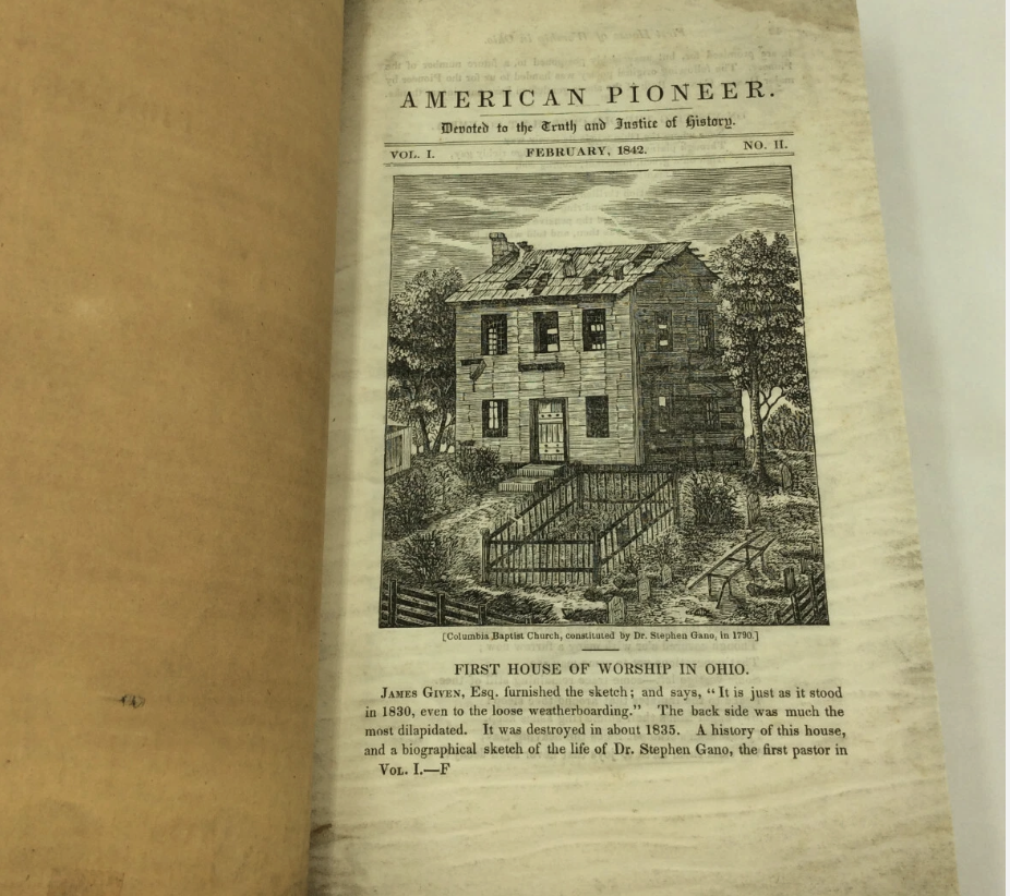
    Following below is a letter written by Benjamin Sharp in 1842 to the editor of a history magazine entitled The American Pioneer, and which was published in Cincinnati, Ohio by John S. Williams. The letter was printed in the June 15th issue of that periodical. It tells first hand accounts of the Battles of Long Island Flats at Kingsport, and of the Indian fighting around Black’s Fort in Abingdon, both during the early phases of the Cherokee War that started as a part of the American Revolution. Following the text of the letter will be a summation of what little biographical material exists on Benjamin Sharp, himself.

    MR. SHARP’S LETTER

    Warren County, Missouri, June 15th, 1842

    Dear Sir –

    In the year 1776, about the time American independence was declared, all that part of West Virginia now contained in the counties of Wyth, Smyth, Washington, Russell, Lee, and Scott, with the adjoining counties in North Carolina (now Tennessee) of Sullivan and Washington, were broken up and the inhabitants driven into strongholds. About the last of June or the first of July, the traders fled from the Cherokee nation with the alarming news, that the Indians were coming in great force, and in a few days would break into the settlements.

    A few of the militia, perhaps one hundred and fifty or two hundred, hastily assembled under the command of captains James Thompson, James Shelby, and William Cook and proceeded to the frontier house, about fifteen miles in advance of the settlement, and begun to build a kind of stockade fort with fence rails; but before they could finish their fort their spies gave them notice that a large Indian force was within a few miles.

    It was then debated, which would be the most prudent, to await their coming in their crazy fort or march out boldly and meet them in the woods. The latter proposition prevailed, and before they had proceeded more than five miles, they discovered nine or ten Indians, who threw down their budgets and fled. This threw the men into disorder, curiosity drawing them around the Indian plunder in a crowd; but presently they heard a noise like distant thunder, and looking round they saw the whole Indian force running upon them at full speed – they made a hasty retreat to a rising ground, where they rallied; and the Indians came running up with savage yells, as if intending to rush among them with their tomahawks.

    A sharp engagement ensued, lasting from one-half to three-quarters of an hour, when the Indians disappeared, as if by magic, leaving the white men masters of the ground. Of the whites none were killed and only four slightly wounded. Eleven or twelve Indians lay dead upon the field and many trails of blood were found where the dead were carried off or the wounded had escaped. My oldest brother and a brother-in-law were in the action.

    A curious incident occurred during the engagement. An Alexander Moore, a strong, athletic, active man, by some means got into close contact with an Indian of nearly his own size and strength; my brother-ion-law, William King, seeing Moore’s situation, ran up to his relief, but the Indian adroitly kept Moore in such a position that King could not shoot him without shooting Moore. The Indian had a large knife suspended at his belt, for the possession of which they both struggled, but at length Moore succeeded and plunged it into the Indian’s bowels; he then broke his hold and sprung off from Moore, and King shot him through the head.

    The victorious party now returned to the fort, and instantly dispersed to take care of their own families and concerns. In the meantime the whole settlements were breaking up and the people fleeing from every quarter. We had collected some horses and loaded them with such necessaries as we could hastily pack up, and about the middle of the day my father, an old man, set off with them and the females of the family to seek a place of safety, he know not where.

    I was dispatched on foot to accelerate the escape of a brother’s and sister’s families, the one living four and the other six miles directly toward the point of danger. I was a little turned of fourteen years of age; the day was warm, but I was light and active and had no encumbrance but my gun and shot-pouch, and I traveled rapidly.

    On my arrival I found the families had fled, and I turned to pursue my father. I had twelve miles to go to gain the great road, which I did as the day was nearly closing. In my whole route I not seen a human face, but here the road was full of people moving hastily along; they were all strangers to me, but learning my situation one man generously proposed to carry me behind him till I could regain my friends or hear some intelligence of them.

    This offer I gladly embraced, and after some time we came to the farm of a captain Joseph Black, where Abington now stands, where we found four or five hundred souls of all descriptions collected together to build a fort, and here I found my connections.

    The next day, when all hands were engaged in procuring materials and building fort Black, we received the news of the battle of long Island, which gave us much encouragement, and business was suspended till a prayer of thanksgiving was offered up by the Rev. Charles Cummings, a Presbyterian minister.

    Not more than two or three days after this a captain James Montgomery, who lived about eight miles off, came to the fort; he had concluded, with two other families, to defend his own house, but not knowing what was going on he had rode out to try to find some people or get some intelligence. He was earnestly beset to bring the families instantly to the fort, and men and horses were sent to assist him.

    They soon returned with the families and some of their effects, and went back for more, but to their surprise they found the houses plundered and all in flames. They retreated hastily to the fort, and spies were appointed and sent out – but for several days they made no discovery, but at length they came in one night after dark and reported that they had discovered afire on the bank of the river above Mongomeies, which they supposed to be the Indian camp.

    An express was sent off to another fort, requesting their men to meet our men at a certain place at a certain hour that night. A party set off with the spies and was met by the men from the other fort according to appointment, and the spies conducted them to the spot. They cautiously surrounded them from the river below to the river above them with strict injunctions to preserve a profound silence till the report of the captain’s gun should give the signal for a general discharge, and in this position they waited for day.

    As soon as day had fairly dawned the Indians arose and began to move about the camp, when the crack of the captain’s rifle was followed by a well directed fire from every quarter; the Indians fled across the river, exposed all the way to the fire of the whites, if any fell or sunk in the river it was not known, but if I recollect right eleven lay dead at and around the camp.

    The men crossed the river and found various trails of blood, one of which they traced up to where the fellow had crept into a hollow log; they drew him out by the feet and found him mortally wounded: he requested them by signs to shoot him in the head, which request they granted.

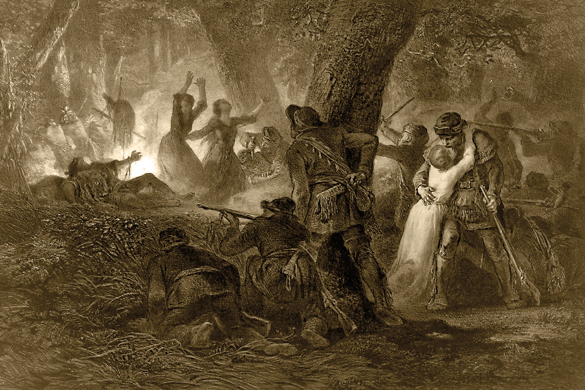
    When the men returned all safe, with the Indian spoils and scalps, there was great rejoicing, and the scalps were suspended to a pole and fixed as a trophy over the fort gate. But we did not enjoy this triumph long, for shortly after a different scene took place.

    One morning three parties prepared to go out; one in which were my father, my two brothers, and two brothers-in-law, went early and was unmolested, they went to visit some plantations twelve miles off, and knew of nothing that had happened behind them, and did not return till late at night.

    Of the other two, one went to a field about a mile off, I think to secure some flax, and the other about the same distance to the house of the Rev. Charles Cummings, to bring his books, and some of his effects to the fort. Both these parties were attacked at the same time in full hearing of the fort; and here an undescribable scene of disorder took place, the women and children screaming, wives clinging to their husbands, mothers to their sons, and sisters to their brothers, to prevent them from going out, and crowding the fort gate, so that the men could hardly pass or repass.

    However a number of the men broke through, and ran to the rescue as fast as possible, but before they could arrive the Indians had done their work and were gone; one man was killed and one wounded in each party. A man by the name of Blackburn, was shot, tomahawked, and scalped, and yet was found alive, brought in, and recovered of his wounds. He was a long time an object of compassion.

    The gallantry of two young men in this affray deserves to be recorded here. William Casey had a sister, a beautiful little girl, about sixteen years of age, along with the party at the field; and as he was running for his life, discovered the Indians in close pursuit of his sister; and at that moment his eyes falling upon another young man, by the name of Robert Hasold, he called to him to come and help him to save Nancy.

    Hasold obeyed, and although there were four or five Indians in pursuit, (some said seven,) they rushed between them and the girl, and by dexterously managing to fire alternately, still keeping one gun loaded when the other was discharged, they kept the Indians at bay till they gave up the pursuit, and they brought the girl in safe. Such acts of generous bravery ought at all times be held up as examples to our youth. Ever after, these two young men stood prominent in society.

    During the summer several murders were committed; two men were killed almost in sight of the neighboring fort, who had gone out to bring in their horses. Of two men who went with an express from fort Black, one was killed and the other made his escape.

    It had been early determined to carry an expedition into the Indian country: and troops begun to assemble at the long Island, the place of rendezvous, and build a fort, which was called fort Henry. A company was enrolled at fort Black, and taken under pay, to guard the fort and escort the provision and baggage wagons going to, and returning from the rendezvous. In this company I engaged, which was the first of my military service.

    I think some time in November, the army, one thousand five hundred, or two thousand strong, under the command of colonel William Christian, of Virginia, moved on the Indian towns. I cannot recollect that this army killed any Indians, or took any prisoners; but they burned down all their villages, destroyed their corn, and every article of subsistence they could find, which reduced them to such a state of starvation, that before spring they sent in a flag for peace, which resulted in the treaty of the Long Island, in 1777.

    I attended this treaty only one day, and that before the conferences begun and can report nothing of my own knowledge; I will only mention an oratorical figure in a speech of the Raven, the principal Indian chief.

    A great many Indians with their squaws and children had collected, and were quartered in the island, surrounded by a guard to prevent improper intercourse with the whites; but notwithstanding this precaution, some abandoned fellow shot across the river and killed an Indian. This produced great confusion; the Indians thought they were betrayed, and prepared to fly, and it was with much exertion the officers and commissioners could convince and pacify them.

    Afterwards when the council met, the Raven opened the conference on the part of his people by a speech, in which he reverted to the case of the murdered Indian. He said, least that unhappy affair should disturb the harmony and sincerity that ought to exist at that time between the white and red brethren, each party ought to view it as having happened so long ago, as if when the Indian was buried an acorn had been thrown into his grave, which had sprouted and grown, and become a lofty spreading oak, sufficiently large for them to sit under its shade, and hold their talk.

    This speech was much talked of at the time, and many thought it equal to any thing in the celebrated speech of Logan. Thus ended the first Cherokee war.

    I am, with much esteem &c.

    Benj. Sharp

    Biography

    Benjamin Sharp is a phantom of our regional past, a sense of whose importance to our heritage needs to be regained. The only widely known reference to him in our historic literature is his cryptic commentary on the death of Chief Bob Benge recorded in Summer’s History Southwest Virginia and of Washington Co. and in the author’s Benge!

    Benjamin was born in Lancaster County Pennsylvania on January 23, 1763. He was the son of John Sharp, who was born in Scotland about 1720, and who died in Sullivan County Tennessee July 1796. John’s home, where Benjamin was raised, was on the South Fork of Holston River, a few miles above the present dam.

    Benjamin acquired excellent social and business contacts by his and his family’s’ marriages. He married Hannah Fulkerson, who was the daughter of James Fulkerson, and the niece of Abraham and sister of Peter Fulkerson. Her mother was Mary Vanhook, whom his father had married when this assortment of families were living in North Carolina.

    The Fulkersons were Dutch Huguenots, and were part of that group that migrated across America to finally settle in Washington County, Virginia, after having first settled in Elk Garden, Russell County. Other clan names that were in that group of wandering Huguenots were the Dyes and the Vanhooks.

    The Fulkersons were high up in the social structure of Washington Co, and Abraham became a Colonel in the Holston Militia, a rank usually reserved for the Scots-Irish. The Fulkersons seemed to serve as intermediaries between the Scots-Irish community and the sizable German one. As a ranking officer in the Holston Militia, Abraham had been a special target of Chief Benge on his last raid in 1794, when Benge sought to attack Abraham’s house near Hiltons, Va.

    The Fulkersons were aggressive and prosperous land speculators in Washington, Scott, and Lee Counties, Virginia. Benjamin would profit much from this connection.

    Benjamin was also the brother-in-law of one of the several William Kings, whose family is connected with the salt works at Saltville, King College, Kingsport, and Steel Creek in Bristol. They were easily the wealthiest family in the region at that time.

    Early records of Benjamin’s activities in the Holston Valley are sketchy. He got a land grant in Elk Garden amongst his wife’s relatives, he got land on Beaver Creek, and moved to the Mendota Community on the North Fork, according to the historian Goodpasture. This made him neighbors with the Livingstons, Benhams, and the Hobbs, all of whom were to be swept up in the infamous last raid of Chief Benge.

    Virginia made money in two ways off of its land sales on the frontier. First of all, it issued land warrants which entitled the holder to claim a specified acreage of unpatented land. These warrants were traded for cash on the secondary market. Then, of course, the Virginia Land Office charged a fee for the land itself, after the purchaser had presented a warrant and a survey of his claim. The land could, then, be sold on the secondary market. The Fulkersons were aggressive traders of both Land Warrants and of Land.

    About 1790 several families from the Mendota community moved to Turkey Cove (Dryden) in Lee County. Their motives involved land speculation, hunting, and community defensive needs. The Cherokee War had raged in sanguine passion since 1776, and in 1777 the Cherokee had run all the settlers out of Lee County save for the eastern most garrison at Rocky Station.

    Late in that war the Holston Militia decided to deploy a rapid deployment force of rangers at Yoakum’s Station in Turkey Cove. Among those settlers of the Mendota Community that relocated to Dryden were the brothers Absolum and Vincent Hobbs, Jr, and likely Vincent Hobbs, Sr., John Benham, and Benjamin Sharp, who bought 620 acres as the assignee of his brother-in-law Peter Fulkerson. The land was next to Absolum Hobbs.

    This started a process that was oft repeated. He either bought warrants or the land itself from Peter Fulkerson, all through Lee County. The land was spread throughout the county, and often was the less desirable left overs after wealthier speculators had gotten the cream. Before the process was over he had acquired 2,622 acres in Lee County in his own right, and was part owner of 1,083 more. He also bought 273 acres on the North Fork of the Clinch near Duffield in Scott County.

    He followed the common pattern of that era, and sold his Lee County holdings so that he could reinvest his profits in land further west, and wound up dying in Warren County, Missouri on January 1, 1844.

    His only claim to lasting fame is his commentary on the actions of the Yoakum’s Station Militia in the killing of Chief Bob Benge in Wise County in 1794. That party was composed of his neighbors Absolum and Vincent Hobbs, Jr., and James Huff and others of the Turkey Cove community. His narrative is written with such authority that one could think that he was one of the members of that party whose name James Huff could not remember half a century later, when he told of that event to a Louisville Newspaper.

    Sharp’s narrative of the Benge killing is rumored to be somewhere in the same periodical that this letter of his was published in. The American Pioneer is on microfilm at Alderman Library at the University of Virginia, the source of this narrative. Perhaps someday someone will be able to locate it. In the meantime, this article will serve to restore the memory of Benjamin Sharp to its rightful place in local history.

    Special thanks to Dale Carter for his help on this article, and to the Lonesome Pine Regional Library for its help in procuring a photocopy of the microfilmed Sharp document.

  • The Location of the Massacre of James Boone and Henry Russell

    The Location of the Massacre of James Boone and Henry Russell

    The site of the 1773 massacre of the son of Daniel Boone and of the son of William Russell – James Boone and Henry Russell – is the subject of a long and continuing controversy in Lee County.  The state historical road side marker commemorating this event was originally placed along side US 58 in Eller’s Gap on Powell Mountain between Pattonsville and Stickleyville.  A rival claimant later developed in western Lee County, and roadside marker was dug up in the middle of the night and replanted near Kaylor.  In recent years a new road side marker was erected by the State in the center of Sticklyville.

    Local traditions still abound, especially near the various springs that head up Wallen’s Creek north of Duffield and east of Stickleyville, and down Wallen’s Creek all the way to its mouth.  The following is a review of the murders, and of the evidence on the location of the site.

    The Great Warrior’s Path was the most significant of the numerous Indian trails in the eastern United States.  It connected the Northeastern and Midatlantic regions with Kentucky and the region between the Ohio and Mississippi Rivers.  Daniel Boone’s name is indelibly stamped upon it, and it is also known by the names The Wilderness Road and the Great Kentucky Road.

    There are several variations of this trail in western Scott County and eastern Lee County.  The Hunter’s Trace skirted the southern face of Powell Mountain from Pattonsville to Blackwater, where it crossed Powell Mountain at Hunter’s Gap, and passed on a mile and a half west of the mouth of Wallen’s Creek on Powell River, which it crossed at White Shoals.  Another route crossed Powell Mountain via Kane Gap between Duffield and the head of Wallen’s Creek, which it followed to Stickleyville.  Here one version crossed Wallen’s Ridge to the head of Station Creek, and on to the west to the northern end of the White Shoals ford.  Back at Stickleyville, another variation continued on down Wallen’s Creek for 2 ½ miles to Fannon’s Spring, and crossed Wallen’s Ridge via Slagle’s Gap to the mouth of Station Creek.  The last version continued down Wallen’s Creek and for a mile and a half past its mouth, where it joined the Hunter’s Trace.

    In 1773 the western extent of pioneer settlement was Castlewood in Russell Co. and the Blockhouse in Carter’s Valley in Scott County, near Kingsport, Tennessee.  Daniel Boone had decided to move his family from the Yadkin Valley of North Carolina to Kentucky, and had persuaded Capt. William Russell of  Castlewood to do so also.  On September 25, 1773 the Boones and five other families sat out, and upon reaching Wolf Hills at present Abingdon, Daniel dispatched his seventeen year old son, James, and the Mendenhall brothers, John and Richard, to leave the main party and to go to Upper Castlewood to pick up Capt. Russell and his party at Russell’s Fort.  Daniel continued on down the main Wilderness Trail to east of Kingsport, and then on up old US 23 to Duffield.  There is no record of whether he accessed Powell Valley by way of Kane Gap, or of Hunter’s Gap.  Once in Powell Valley the Boone Party joined the party of William Bryan, which contained about forty people.  We know that he camped that night on the northern side of Wallen’s Ridge, which itself is north of Wallen’s Creek.

    James followed present US Alt. 58 to Castlewood and found that Russell and his party of about forty pioneers were not ready to leave.  To carry this news to Daniel, Russell’s seventeen year old son, Henry, and James Boone along with Isaac Crabtree, the Mendenhall brothers, and two slaves, Adam and Charles, were dispatched on Oct. 8th ahead of the main Russell party.  Also among the emigrants from the Russell Party were the Hargis brothers – Samuel, Whiteside, William, James, John, Benjamin, and their families.  They left Russell’s Fort with James Boone and his party, which traveled down the Clinch Valley branch of the Wilderness Trail until they regained the main Wilderness Trail just north of Natural Tunnel.

    Daniel and his party camped along the Wilderness Trail on the north side of Wallen’s Ridge somewhere in Powell Valley, and waited for the Russell party to catch up.  It was, of course, the party of James Boone that was trying to catch up with Daniel, and not that of Russell.  Somewhere James’ party lost the trail, and night fall caught them somewhere on Wallen’s Creek, three miles east of Daniel’s camp.

    James could have lost Daniel’s trail either at Duffield or at Stickleyville, depending whether Daniel had taken the Hunter’s Trace, or the Warrior’s Path over Kane Gap and then on to the head of Station Creek.

    It is at this point that the speculation begins.  The Wilderness Trail at this time was just a foot path.  Horses were usually led as pack animals, and not ridden.  The Trail from Kane Gap was a corridor rather than a single path, as it followed a branching network of buffalo trails.  At times of low water the travelers tended to stay on the flat northern bank of Wallen’s Creek, but during muddy and wet times they took the ridge line further to the north of the creek bank.

    There are three variations of the Wilderness Trail leaving Stickleyville to the west, and we do not know which versions were being traveled by James, and perhaps Daniel.  All three versions enter Wallen’s Creek Valley via Kane Gap, and proceed down Wallen’s Creek to present Stickleyville.  There is a fork in the trail at this point, with one following present US 58 on across Wallen’s Ridge into the Valley of Station Creek, which runs parallel to Wallen’s Creek, both emptying into Powell’s River.

    Another variation of the Wilderness Trail continued on west down Wallen’s Creek to Fannon’s Spring, which is about two and a half miles west of Stickleyville.  Implicit in the circumstances of this story is the fact that the party would have camped by a spring.  The pioneers did not usually drink out of creeks anymore than we do.  Fannon’s Spring lies between the road and the creek, and its flow is so great that it boils in a mushroom shape up out of the ground.  Its fresh cold water attracts fish as it empties into the creek.  It is simply the best spring for miles around.  It was at this point that the trail began its ascent of Wallen’s Ridge on its way to Slagle’s Gap, and joined the trail on Station Creek at its mouth on Powell River.

    A third version continued on down Wallen’s Creek to its mouth on Powell River, and crossed to the north side to rejoin the versions of the Wilderness Trail coming west from the ford at the mouth of Station Creek.

    The militiaman John Redd, who had gone with Joseph Martin in 1775 to Martin’s Upper Station at Rose Hill by way of the Wallen’s Creek route, stated that “the old Kentucky Trace crossed Walden’s ridge at the head of Walden’s Creek”.  This is the current route of US 58 west of Stickleyville.  It implies that Redd believed that Daniel would have gone this way, but Redd admitted that his first trip to Kentucky was in 1780, some seven years after the massacre, a situation that gave plenty of time for the route of the trail to have changed.

    Tradition does say that Daniel Boone changed the route of the trail after James was killed.  In 1884, Col. Auburn Pridemore, CSA, of Jonesville, wrote a treatise entitled “Routes East”, and which now is MS 4.8.12 within the Draper Manuscripts.  A transcription of a portion of this document is as follows:

    “I have mentioned that Boone, after this (the James Boone massacre), changed his route; that was told me by Genl. Peter C. Johnston, brother of General Joseph E. Johnston of Confederate memory, he had it from a Mr. Fleener whose father camped at the top of Walden’s ridge at Stickleyville; when Boone and Gov. Dunsmore’s surveyors located the road, and he gave the Killing of Boone’s Son as the reason for the change of route.  This was
    told me incidentally as Genl. Johnston (who had a great fund of Indian tales and Border adventures) was relating a very thrilling story of a contest of the elder Fleener with an Indian at the same place.”

    The location of the murder of James Boone depends on which version of the Wilderness Trail Daniel was traveling, and which route James took in the process of getting lost.  We know that nightfall of October 8th caught the party of James Boone and Henry Russell still on Wallen’s Creek.

    “Wolves” howled all night around the camp of the James Boone party.  The Mendenhall brothers paced up and down all night.  At dawn, a mixed party of Shawnee and Cherokee Indians attacked, and shot James Boone and Henry Russell through the hips so that they could not escape.  They were tortured with knives.  Boone recognized his torturer as Big Jim, a Shawnee who had been a guest at Daniel’s home in the Yadkin.  Boone resisted for a while, but with his hands shredded from fending off the knife, he pleaded with Big Jim to kill him and to put him out of his misery.

    Russell was clubbed, and his dead body shot full of arrows.  The Mendenhalls, and Whiteside Hargis were also killed.

    It is not clear how Crabtree made his escape, but he returned to the settlements in the east.  Adam hid under a pile of drift wood on the bank of Wallen’s Creek, and witnessed the massacre, and later returned to the settlements where he spread the news.  He and Crabtree were the sources of the information that was written into the dispatches of the Holston Militia that wound up as part of the Draper Manuscripts, which are today’s documentation of this event.  Charles was carried away toward captivity.

    The story varies somewhat at this point.  One tradition says that the massacre was discovered by a deserter from Daniel’s party.  Another source says that Capt. William Russell’s party came upon the scene, and dispatched a runner to Daniel.  The party of Daniel Boone returned, and Rebecca, James’s mother, wrapped the bodies of James and Henry up together in a linen sheet, and they were buried in a common grave.  The Boone and Russell parties returned to Castlewood.

    The Indians, taking Whiteside Hargis’ wife, John and William Hargis, and John’s son who was named after his Uncle Whiteside, along with the slave Charles, made their way back up Wallen’s Creek to Dry Creek at Stickleyville, and thence to Kentucky, probably by way of Lovelady Gap, and either Olinger Gap or Eola Gap to the head waters of the Cumberland River.  Somewhere along the trail, John Hargis and his wife and daughter made their escape, and settled back in Castlewood.  Young Whiteside was adopted by the Shawnee, and later in life joined Chief Benge in his raids against the settlers in the area of his capture.

    The Indians along their way began to argue about the ownership of Charles, and the issue was resolved by his being tomahawked.

    These events are documented by the Draper Manuscripts 6 C 14; 6 C 7-20; 6 S 79-83; 11CC 12; 13C 133; which are well collated in the book Indian Raids and Massacres of Southwest Virginia by Luther F. Addington and Emory Hamilton.  The Fannon’s Spring data is contained in an article in the “Powell Valley News” written by J. M. Moseley and published in 1958 or 1959.   Moseley had frequented the Fannon home at Fannon’s Spring a little over a hundred years after the massacre, while the oral
    traditions were still fresh and widely held.  The Hargis information is obtained from Henrietta Hargis Reynolds’ article in The Heritage of Russell Co. vol II.

    The most persuasive information concerning the location of the murders of the James Boone Party is the testimony of Adam, whose story was recorded by militia officers at the time.  Adam said that he hid under a pile of driftwood beside Wallen’s Creek beside the Wilderness Trail.  Wallen’s Creek is too small to build up such a large pile of driftwood much above Fannon’s Spring, so the reputed sites upstream from Stickleyville are impossible.  This is especially true of those sites at the head of Wallen’s Creek, which is so small there that it can be stepped across.

    We know that Daniel and James took different trails, as James “got lost”.  Since James was on Wallen’s Creek, and was lost from Daniel’s trail, this means that Daniel had taken either the Station Creek version of the trail, or the Hunter’s Trace.  If the Russell Party was the one that discovered the massacre of the James Boone Party, and since we know from several sources that the massacre occurred on Wallen’s Creek, then it would seem that Russell had known to follow the parties of Daniel and of James down Wallen’s Creek.  It is important to note that at its nearest point, the Hunter’s Trace passes 1 ½ miles to the west of the mouth of Wallen’s Creek.  Therefore Russell in his following of the Boones had known that they were not to have traveled on the Hunter’s Trace.

    If one discounts the Fannon’s Spring tradition, and discounts Russell having discovered the massacre, there are only two possibilities for these events to have unfolded.  The first is for Daniel to have camped north of Powell River (which is north of Wallen’s Ridge) somewhere in the Flatwoods or White Shoals area, and for James to have camped near the mouth of Wallen’s Creek.  The Wallen’s Creek Trail and the trail that had come from Station Creek come together at White Shoals.  This would have placed James about three to four miles east of Daniel, and also would have allowed the deserter from the Daniel Party to have backtracked to the east on a different trail from the one he had followed with Daniel.

    The other possibility is for Daniel to have camped at the mouth of Station Creek, and James to have camped at Fannon’s Spring.  The distance between these two sites is also about three miles, and would have also allowed the deserter to have taken a different route back east and to have stumbled upon the massacre.

    However, if one credits either the Fannon’s Spring tradition of Mosley, or the tradition that Russell discovered the massacre there is only one possibility.  The preponderance of evidence points to Daniel’s having camped at the mouth of Station Creek, and James at Fannon’s Spring.  It is, after all, about fifteen miles from Fannon’s Spring to the mouth of Wallen’s Creek and to the Flatwoods segment of the Wilderness Trail.

    The Wallen’s Creek location documented by the Draper Manuscripts excludes the tradition locating the massacre in western Lee County near Kaylor.  Also, the western Lee County site is over a hundred miles from Castlewood, easily twice the distance that the James Boone party could have made in the one day that they travelled.

    After burying their dead, the Boone and Russell parties returned to Castlewood.

    AN EXCERPT FROM THE BOOK ON THE WILDERNESS ROAD  BY THE AUTHOR
    copyright November 2006
    All rights reserved

    Lawrence J. Fleenor, Jr.
    Big Stone Gap, Va.

  • Baker’s Flats

    Baker’s Flats

    Copyright
    Lawrence J. Fleenor, Jr.
    Big Stone Gap, Virginia

    June 2014
    Revised April 2016

    Baker’s Flats is a plateau located in Virginia, but touching the Kentucky state line.  It is where Black Mountain, Indian Mountain, and Pine Mountain come together, and is the take off for Roger’s Ridge, which separates Roaring Fork from Black Creek.  It is about a mile north to south, its long dimension.  It overlooks the origins of Roaring Fork, Guest’s River, and both the South and North Forks of the Pound River at Fox Gap and at Flat Gap.  Just off its northern edge, and into Kentucky, the head spring of the Poor Fork of the Cumberland River starts at the head of Robert’s Branch Hollow.  The spring is just under the level of the flats.

    A few hundred yards to the east, after having passed the state line back into Virginia, is the start of the South Fork of the Pound River, one of the head waters of the Big Sandy River.  It also starts in a spring coming from a coal seam lying under Baker’s Flats, in this instance at the head of Phillips’ Creek.  There is a massive ancient rock house built into the face of the bluff by the spring.  Baker’s Flats, and the land under the bluff, have been heavily strip mined, but the bluff has not been disturbed because of its massive near vertical positioning.  The spring and the rock house have thusly been preserved.

    Access to Baker’s Flats is best obtained by way of Roaring Fork in Virginia.   From Business US 23 pick up State 603 at Kent Junction and proceed to the old mining camp of Roaring Fork, and proceed north off of the paved road that turns to the left, and go up the dirt mining road officially called The Roaring Fork Road.  Many people today have come to refer to this road as the Pine Branch Road.  Staying as close to the creek as possible, follow the road to the headwaters of the creek, and then follow the road up the face of the mountain toward the current wind gage in the center of the flats.  To get to the rock house, proceed north on ATV trails not suitable for 4-wheel drive highway vehicles, and go to the edge of the strip mine.  You will have to poke around a bit to find the spring and rock house, but there is an ATV trail that comes up from Phillips’ Creek Hollow that accesses Baker’s Flats that you can follow from the Flats to the rock house and spring.

    Before it was strip mined, the flats were the site of active farming well into the mid Twentieth Century.  The name “Baker’s Flats” is widely known in the community of Flat Gap, and formerly so among the people of Dunbar.  No one recalls a family of Baker’s having lived there, and the name of the place seems to go back to forgotten times.

    Roaring Fork was much favored by long hunters, as were the other long sheltered hollows on both sides of Black Mountain.  Buffalo, elk, and deer spent their summers in the open meadows on top of the mountain, and sought shelter in the deep hollows in the winter.  Access from Virginia was gained by coming up the Big Stoney Creek trail and over High Knob and across Little Stone Gap to the top of Little Stone Mountain, where the trail dropped off to Kelly View and current Kent Junction, where the mouth of Roaring Fork is.

    The name Pot Camp Creek is a living testament to the long hunters having frequented the current locations of Dunbar and the former Pardee.  Bold Camp, near Pound, Virginia, was settled primarily by people coming up Roaring Fork and dropping down into the head waters of the South Fork of the Pound River, which they followed to the mouth of Bold Camp.

    Just who were Baker’s Flats named after?  The most likely candidate is Captain John Baker, who was a documented long hunter from Ashe County, North Carolina.  Ashe County is a very common site of origin for the earliest inhabitants of far southwest Virginia, especially the region about Black Mountain.  These settlers came down the New River through Mouth-of-Wilson.

    Baker was born in 1758.  In 1769 at age 11 he joined a party of about 40 long hunters led by James Knox.  Following common operating procedure, the party went as a group before dispersing at Flat Lick just west of present Pineville, Kentucky.  All that is documented is that they were gone for over a year before they met each other again at Flat Lick, and then returned to Ashe County.

    It would seem likely that Baker followed the Cumberland River to its head spring, and there found his own private mountain top meadow filled with game.  He built a combination blind and living quarters over the major spring used by the game, and just waited for dinner to come to him.

    The presence of the many carefully placed large stones within the structure of the rock house show that its builder was there for a long time.

    Modern DNA evidence has shown that this ‘historic’ John Baker really was more than one individual of that name.  Assignation of the various bits of information to a particular one of them is still a work in progress.

    However, quite by accident, a land grant (LO 110-665) on file at the Library of Virginia, and available on line, has been found, and which contains an 1853 survey call for a line that is identified as “passing Baker’s Rock House”.  This proves that the structure in the accompanying photograph, and which is known traditionally locally as ‘Baker’s Rock House’, is the same one identified by this survey.

    This grant is of further historic interest for several reasons, among them is the fact that the recipients of this grant were William Carnes and Loring Tyler.  Carnes had also bought a grant in this vicinity in partnership with William D. Duff.  Duff was the son of Robert Duff and his wife Polly.  Polly was the niece of Fannie Scott.  Fannie Scott was the famous survivor of the Chief Bob Benge’s raid at Scott’s Station at the head of Wallen’s Creek on the Wilderness Trail of 1779 in which her children and husband, Archibald, were murdered.  The Duffs had acquired all the Scott land after that massacre.

    The calls of LO 110-665 also note that the last survey corner was “70 poles north of Gabriel Church’s house”.   This comes to about 300 yards.  This notation is remarkable in its uniqueness of calling attention to a house located at that great a distance from the survey.  Church (1802-1875) was a well known character in what was to become Wise County.  He was born in Wilkes Co., North Carolina, and was highly regarded as a musician.  He lived on Gabe’s Branch, which was named after him.  It was said to be a tributary of Roaring Fork, but its exact location has been lost to record.  This survey call places it on the eastern slope of Fork Ridge just to the west of the southern end of Baker’s Flats.

    Church was well known for having written the ballad “Poor Goins” about the murder of Alexander Goins at Mud Lick on Callahan Creek in 1844, which is on the western side of the Nine Mile Spur directly across from Gabe’s Branch.  It is intriguing that Goins’ sister, Elizabeth Jane, lived with her husband Michael Peter Craiger one hollow to the east of Gabriel Church, on Black Creek.  Craiger served with the “Yankee Catchers” in the Civil War.  This group was one of the Confederate bushwhacking outfits.  Elizabeth Jane’s descendent who wrote about her says that the Goins and Craiger families were from Wallen’s Ridge in Lee County, Virginia.

    Bibliography:

    1 – Peyton, J. Lewis –  History of Augusta County

    2 – Chestnut, David – “Long Hunters” – RootsWeb.com

    3 – Hamilton, Emory – “The Long Hunter” – printed in the Spring 1984 “The  Mountain Empire Genealogical Quarterly”

    4 – Virginia Land Office Patents and Grants / Northern Neck Grants and Surveys

    http://lva1.hosted.exlibrisgroup.com/F/?func=file&file_name=find-b-clas30&local_base=CLAS30

    5 – Fleenor, Lawrence J. – Daniel Boone Wilderness Trail Assn.  – “Scott’s Station”

    6 – Fleenor, Lawrence. J. – Black Mountain, the Mother of Today pgs 56-64

    7 – http://www.bakerdna.net

    8 – http://freepages.genealogy.rootsweb.ancestry.com/~jrbakerjr/dna/dna.html

    The stone wall to the left is part of the original structure.  The sawed lumber frame in the front is from the more modern era when the shelter was still inhabited.  The head spring of the Cumberland River is to the right of and down about 20 feet from the structure.

  • Allen’s Way Station

    Allen’s Way Station

    DISCOVERY OF ANOTHER EXISTING WAY STATION
    ON THE FINCASTLE TO CUMBERLAND GAP TURNPIKE

    Copyright 11-16-13
    Lawrence J. Fleenor, Jr.
    Big Stone Gap, Va.

    Earlier this fall Mr. Eunice Laster, of the head of Wallen’s Creek, told me that there was an existing way station from the Fincastle to Cumberland Gap Turnpike yet in existence in Stickleyville. Yesterday I followed his directions, which was to go past the Stickleyville fire station and that it would be there. I turned west onto the Middle Fork of Wallen’s Creek Rd. in the south side of Stickleyville on State 612, and immediately turned left onto the old loop of US 58 & 421 that used to be the main street of town. The fire station was 50 yards on the left. Passing that I crossed Wallen’s Creek, and followed the now dead end of the loop as it approximated the current US 58 & 421. On the left at the end of the now cut off loop of old road stood an old wood house with a strikingly familiar, yet odd, upper front porch. After thinking a moment, I realized that it was the same unique design as that of the known Fincastle Turnpike Way Station that used to stand just to the south of Rose Hill. I had a photograph of it in Bear Grass. Comparing the two, they seem to have been made from the same design. The tightness of the overhand over the upper front porches, and the bannister designs are the same. There was no trouble believing that Mr. Laster was right.

    However, a photograph of the Allen Station house from 1904 shows that that front porch was added after 1904, the date to that picture. It would seem likely that the Rose Hill way station also had its front porch added in the same time frame as Col. Allen’s.

    Review of the CD (second image) of the 1833 official map of the postal route version predating the 1844 Fincastle to Cumberland Gap Turnpike that I have from the Library of Virginia showed that this way station was mile post 50, starting where the road entered Virginia from Tennessee near Cumberland Gap. It was labeled as belonging to “Col. Allen”.

    Review of page 903 of Bales Early Settlers of Lee County, Virginia and Adjacent Counties shows the following the information:

    James Allen came up the Powell Valley from Claibourne Co., Tennessee, and married Hannah Hanger. They bought land on Wallen’s Creek from John and Susannah Eller (recall Eller’s Gap where US 58 traverses Powell Mountain).

    James Allen represented Lee Co. in the House of Delegates in 1824, and served two terms. In 1833 (the date of the map) he obtained a license to keep “a house of private entertainment”. This would indicate that his way station was also an inn, as was common among the better way stations. The lesser ones, such as the Carter House of Rye Cove, and now reassembled in Natural Tunnel State Park, were used only as places where the horses were changed on the stage coaches.

    James Allen was High Sheriff in Lee Co. in 1834, and died in 1840.

    The evidence therefore shows that this way station was also an inn, and was built in 1833 as part of the improvement in the Postal Road that followed the old Wilderness Road. It, therefore, predated the Fincastle to Cumberland Gap Turnpike by 11 years. It’s owner is documented. The way station passed to his son, John Hanger Allen 1839, apparently in anticipation of Col. James Allen’s death. Therefore, it likely served the Turnpike after the Col.’s passing.

  • Tangier Island, Max Meadows, The German Brethren, and the Wilderness Road

    Tangier Island, Max Meadows, The German Brethren, and the Wilderness Road

    By: Lawrence J. Fleenor, Jr.
    Copyright and All Rights Reserved
    March 2015

    Significant assistance from Edgar A. Howard

    In 1745 a most pregnant comment was made by Col. John Buchanan. Buchanan was chief surveyor for the Loyal Company of Virginia, and was travelling west down a version of the Wilderness Trail to examine the lands he, in the name of the land company, had jurisdiction over along its course. He stopped at William Mack’s home at today’s Max Meadows, which –though transliterated – were named after him.

    Buchanan’s entries in his Wood’s River (old name for the New River) Land Entry Book for October 16, 1745 states “…. Buchanan road on to William Mack’s place at present Max Meadows. Mack was probably from the noted Mack milling family in Schriesheim, Germany, whose father Yost Mack founded the German River Baptist (Dunkard) faith.

    “Buchanan found Mack dead in his cabin but with him several “Long Beards” or Siebentangers from Ephrata Cloister, Lancaster, County, Pennsylvania. Newly arrived, they would build a settlement called Mahanaim.”

    “The next day Buchanan with Adam and Jacob Harmon appraised Mack’s estate agreeing with the “Long Beards” to gather the crops ….”.

    The Harmons (Hermann) were also German, but seemed to have come to the New River Valley before the Dunkards. They settled on the Northern side of current Radford by 1738.

    Col. Buchanan’s facility with German is all the more surprising given his use of the spelling “road” for “rode”.

    The Wilderness Road

    Buchanan had been born in Ireland, and settled in the ‘Irish Tract’ in present Augusta County (Staunton), Virginia. The entire tract was named ‘Beverly Manor’. His notations in the Land Entry Book indicated that he had started his October 1745 trip in the Upper James River, which is that part that lies to the north of the Blue Ridge Mountains.

    Buchanan had patented the ‘Cherry Tree Bottoms’ along the James River right where the James burst through on the northwest side of the Blue Ridge. The main branch of he Wilderness Trail crossed the James there at Looney’s Ferry. A town later grew up there that is named after him.

    The Wilderness Road (Trail) was the main Indian path in the Eastern United States. It ran from the Hudson River Valley to the Blue Grass of Kentucky. Through out the Great Valley of Virginia it had several variants. The main trail, more or less followed by US 11, had the disadvantage of a precipitous climb up Christiansburg Mountain. Many pioneers took either of the two alternatives to the main route from Buchanan to Draper’s Meadows (Blacksburg / Christiansburg), which were either up Catawba Creek or Craig’s Creek. Buchanan noted that he had taken the Catawba Creek Trail.

    If the traveller had taken the main route of the Wilderness Trail, he would find himself facing a crossing of the New River at southwest Radford, at Ingle’s Ford / Ferry / Bridge. This today is close to the route of I-81. If he had taken either of the alternative routes, he would have found himself on the road to Pepper’s Ferry, which crosses the river just north of US 11. Buchanan correctly records that he was on the road that led to Max Meadows, which is on the Pepper’s Ferry route. The two routes come together at Wytheville, which is one of the reasons for that town’s existence.

    Just south of Max Meadows by State 121 lies Fort Chiswell on the main Wilderness Trail (US 11 & I-81). US 52 runs from there to (Winston-Salem). It also was the Lead Mines of Austinville’s face to the world. The fort was built in 1761 as part of the French and Indian War as a wintering quarters for the expedition of Col. William Byrd III, which had been dispatched to the relief of Fort Loudoun on the Little Tennessee River. That November Major Andrew Lewis built a military road from Fort Chiswell to the Long Island on the Holston (Kingsport Tennessee), which is called “the Island Road”, and is followed today by I-81.

    The Berbers

    The Berbers are the indigenous Caucasian people of Northwest Africa. They had been forcibly converted to the Muslim faith by their Arab conquers. In 711 the Berber Governor of Tangier, Morocco was invited to intervene in a Spanish civil war. He took his Berber army with him to Spain, and after winning the war, assumed possession of the Iberian Peninsular. Hundreds of years of warfare between the Christian Spaniards and the Berber Spaniards ensued. In 1492 the Christian forces won, and started a genocide of the Muslim Berbers. Tens of thousands were murdered, or sold into slavery in the New World. Many wound up in Virginia and in North Carolina. Some converted to Christianity (Conversios) and were sent as settlers into the New World. North Carolina, along its border with Virginia, had a string of fortified settlements of these people. In 1588 Spain abandoned most of its North Carolina settlements in the withdrawal to St. Augustine, Florida caused by the planned invasion of England by the Spanish Armada.

    Some Conversios, joined by some Caribbean French Huguenots, became pirates, praying upon the Spanish treasure galleons as they passed up the Carolina and Virginia coasts on their way to Spain. The Spanish term for these pirates was ‘Picaroons’.

    Tangier Island

    Tangier Island lies in the Chesapeake Bay just south of the Maryland / Virginia line. It had long been used as a base of operations against English shipping in the Chesapeake Bay area, and was finally settled by the Picaroons. They named the place Tangier Island, in memory of their homeland, Tangier Morocco. Among the first settlers were the French Huguenots, the Crocketts. This surname remains the most common surname on the Island.

    The German Brethren

    In the early 1700’s in the lower Necker River Valley around Heidelberg a small group of Pietists broke away from the Lutheran Church. They were esthetics, and did not believe it state religions. They are closely related to other similar German Pietist sects, such as the Amish and Mennonites, and are all theological descendants of John Huss. Some of them considered Saturday to be the Sabbath, and some did not baptize, and some required total immersion. The men never shaved their beards, hence Buchanan’s having referred to them as “the Long Beards”. They never numbered more that 200 in Germany. They organized in 1708. They were persecuted, and scattered to the four winds. Records of all of them do not exist. The group easiest to follow is that led by Alexander Mack, Sr. of Schriesheim, who led a group to the Brethren community of Ephrata Cloister in Pennsylvania in 1729. It is significant to note that there were already unspecified groups of them there when Mack got there. Alexander Mack died in 1735, and the Brethren community began to fragment.

    Is should be noted that Buchanan gave all the correct information about this individual, including the fact that he had come from a family of millers in Germany. However, he gave his common name as ‘Yost’.

    There is a common confusion over the given names of German Americans because of the difference in the naming traditions of the Germans and of the British. In Britain the common name is the first name, but in Germany in the majority of cases the first name was the name of the Saint on whose day the infant was born, and the elective common name is the second name. This second name is the name the individual’s family used to call them by, and the one used by friends who were close enough to have used his “calling name”. Their British American neighbors often thought that their common name was their first name, and often wrote this second name down in records as the first name. Likely Mack’s name was Alexander Yost Mack.

    Alexander Mack, Jr. led a portion of the Ephrata Cloister community “into the Wilderness” “beyond Christian civilization” to Dunkard’s Bottom on the New River in Virginia. He had a son named ‘William’ who is often confused with the William Mack that Buchanan had found dead in his cabin at Max Meadows in 1745. William, the son of Alexander Mack, Jr., was not born until 1747, and served in the Revolutionary War. No other William Mack can be identified in this family cluster. Quite likely we are dealing again with the naming pattern problem, and are confusing first names with given names. No one knows who this William Mack was, or whether “William” was his first or second name.

    Incidentally, this pattern of using the second name as the common name still exists in Southwest Virginia.

    When the Dunkards first came to the New River bottom land that would be named after them, they found living there “a kind of white people who wore deer skins, lived by hunting, associated with the Indians and acted like savages”. The only likely source of these white people living with the Cherokee was the Berbers.

    The Siebentanger

    The most startling aspect of Buchanan’s comments about the events in William Mack’s cabin on Reed Creek at Max’s Meadows is his having called the seven Long Beards present at the wake as “Siebentanger” from Ephrata Cloister. This German term translates as “seven men from Tangier”. Note that this term does not differentiate between Tangier Island, and Tangier, Morocco. Also note that Buchanan equated the two slang references “Long Beards”, and “Tangers”, at the same time acknowledging that they were from Ephrata Cloister, Pennsylvania, and hence German Brethren.

    The implication of this is significant. Buchanan felt that his readers throughout Virginia would equate the terms “Tanger, Long Beards”, and Brethren or Dunkards. How could this be so? Why would the term ‘Tanger” be term that would first occur to a Virginian for a Brethren?

    Histories of Tangier Island do not mention the Brethren. However, the first cases of Maple Syrup Urine Disease ever discovered were discovered around Tangier Island. It is a genetic disorder among members of the German Pietist sects, specifically the Amish, Mennonites, and Brethren. In fact, another name for this condition is “Tangier Disease”.

    The churches on Tangier Island are mostly either Baptist or United Methodist. In both cases, these specific churches on Tangier Island say that they are descended from Churches of the Brethren. Early on in America the Churches of the Brethren split into divisions that were described as being either “like the Baptist” or “like the Methodist”. In fact, the current United Methodist Church nationally is the result of the union of the Evangelical United Brethren and The Methodist Church.

    Similarly, there are concentrations of Brethren Churches in Tangier, Ohio, and in Tangier, Indiana. There are even Brethren churches in the vicinity of Morocco, Indiana. This last reference is all the more tantalizing because the Berber Picaroons who first founded a settlement on Tangier Island were originally from Morocco.

    An affinity between Brethren and Tangier Island and of Tangier, Morocco is further documented by the fact that the Brethren maintained a church mission in Tangier, Morocco in the mid 19th century.

    The Midwest was settled soon after the Revolutionary War. There is no documentation, either direct or indirect, of the Brethren being on Tangier Island after their exodus to Ohio and Indiana. They emigrated to the Midwest, leaving only their religion, and Tangier Disease, behind. None of the German Dunkard’s surnames remain on Tangier. However, this data brackets the time period of Brethren residency on Tangier Island, which would have been roughly 1730 to 1800. This represents three and a half generations.

    Col. John Buchanan’s 1745 comment in Max Meadows calling the seven Brethren gentlemen from Pennsylvania “Tangers” shows that to that generation of Virginians, Brethren were equated with Tangierians.

    But the mindset of Virginians even extended further back into history than that. Recall the Picaroons? During the American Revolution, Tangier Island remained a Loyalist bastion. A small navy of Loyalist Tangierians preyed upon Rebel shipping in the Chesapeake. The rebels of Maryland and Virginia referred to these people, and to their fleet, as the Picaroons. Maryland and Virginia attacked the Picaroon Fleet in what has been called the largest naval battle of the Revolution, and destroyed it.

    This state of affairs may have been the event that sent the pacifist Long Beards fleeing from Tangier Island. There are no German names listed among the participants in this fighting. Yet, after 3½ generations on Tangier Island, the Brethren seem to have acquired a pleasant sense of identity with the place, as they carried its name to their new homes in the Midwest. The related issues of their naming one of their new homes in Indiana “Morocco”, and their decision to establish a mission in Tangier, Morocco raise the question of whether or not their association with the Berbers of Morocco may not have been of longer standing than their sojourn on Tangier Island, Virginia.

    It is a fact that the French and Indian War pushed the Dunkards out of Dunkard’s Bottom and into the Yadkin Valley of North Carolina, where they continued to live with the Berbers they had met in the New River Valley of Virginia and on Tangier Island.

    Bibliography:

    Johnson, Patricia Givens – The Early New River Settlement
    Buchanan and the Siebentanger –
    rootsweb

    White Savages of Dunkard’s Bottom
    waymarking.com

    Fort Chiswell, Island Road, and Maj. Andrew Lewis
    Fleenor, Lawrence – The Bear Grass, a History

    Berber Conquest of Spain
    britannica.com

    Berber Picaroons of the Cheasapeake Bay and of Tangier Island
    http://archiver.rootsweb.ancestry.com/th/read/VAMONTGO/2000-02/0950992885
    Shores, David – Tangier Island – Place, People, and Talk
    books.google.com

    Ephrata Cloister
    wikipedia.org

    Dunkard’s Bottom
    waymarking.com

    Brethren of Tangier Island
    rootsweb

    Tangier Disease (Maple Syrup Urine Disease)
    ghr.nlm.nih.gov
    the-scientist.com

    Brethren Churches in Tangier, Ohio and Indiana
    books.google.com

    Brethren Churches in Morocco, Indiana
    wikipedia.org

    Brethren mission to Tangier, Morocco
    library.manchester.ac.uk – NOT WORKING

    Revolutionary War and the Tangier Island Picaroons
    Rhoads, James – Somerset County
    books.google.com